Row River Trail
check with the trail manager for updated details before visiting.
Row River Trail
Bureau of Land Management
Backcountry Trail
Rail Trail
Urban Trail
- Length
15.5 miles
- Elevation Gain
--
- Route Type
out & back
- Length
15.5 miles - Elevation Gain
-- - Route Type
out & back
The Row (rhymes with cow), offers year-round enjoyment to visitors who enjoy beautiful vistas that change with the seasons.
Location: Trail begins within downtown Cottage Grove, OR and extends east @ 17 miles. The BLM manages the vast majority of the trail beginning at Mosby Creek Trailhead (MP 3). This rail trail winds through rural and forested lands, and parallels the north shore of
- States: Oregon
- Counties: Lane
- Cities/Townships: Cottage Grove, Dorena, Culp Creek
The vision of the Row River Trail began in 1992 when a multi-agency/private citizen working group was organized to foster a Rails-to-Trails project for the abandoned Oregon Pacific & Eastern (OP&E) rail line.
The OP&E line was owned and operated by the Bohemia Mining Company and utilized to haul ore, logs, supplies, and passengers between Disston and Cottage Grove. The Northwest Oregon District Bureau of Land Management (BLM) acquired 14 miles of the abandoned railway in 993 for the settlement of a debt from a timber sale default. The BLM began planning for the rail-trail conversion with the completion of the Row River Trail Master Plan (1993).
In 1998, the BLM officially opened the multiple-use paved trail from the Mosby Creek Covered Bridge to Culp Creek. In 1994, the City of Cottage Grove acquired the remaining 3-mile segment of the OP&E rail line that extended from Mosby Creek into the historic downtown district.
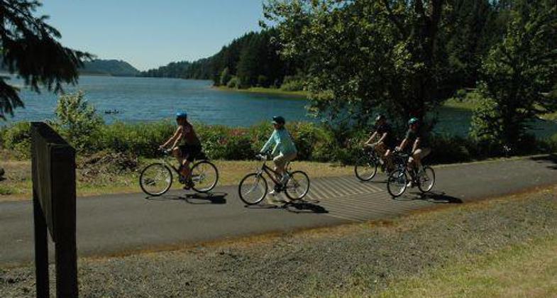
The Row River Trail is now 15.6 miles and connects the city of Cottage Grove to Dorena Lake, Culp Creek, and the nearby Umpqua National Forest. The trail traverses a variety of landscapes that include urban lands, pasture and farmland, timber lands, the Dorena Lake shoreline, and the Row River.
Accessibility Information
No text provided.
Allowed Uses:
Bicycling Boating, motorized Boating, human-powered Swimming Dogs, on leash Equestrian Hiking/WalkingOther Activities
- Heritage and history
- Wildlife viewing / observation
Public Contact
Northwest Oregon District BLMSpringfield Interagency Office
Springfield, OR 97477
[email protected] • 541-683-6600
www.blm.gov/visit/row-river-trail
Contact the trail manager for current maps and visiting details.
More Details
- Elevation (low): 641
- Elevation (high): 796
- Elevation (cumulative): --
- Part of a Trail System? No
- National Designations: None/unknown
- State Designations: State Scenic Bikeway (pending designation)
- Surface (primary): Paved
- Surfaces (additional): Paved
- Tread Width (average): 96"
- Tread Width (minimum): --
- Running length (minimum): --
- Tread Grade (average, percent): 3
- Tread Grade (maximum): 5
- Running length (maximum): --
- Cross-slope (average, percent): --
- Cross-slope (maximum): --
- Running length (maximum): --
- Certified as an NRT
May 31, 2005


