Rydell Refuge Trails
check with the trail manager for updated details before visiting.
Rydell Refuge Trails
U.S. Fish and Wildlife Service
Backcountry Trail
- Length
7.5 miles
- Elevation Gain
--
- Route Type
Loop
- Length
7.5 miles - Elevation Gain
-- - Route Type
Loop
This backcountry trail system extends over 7 miles throughout the Rydell National Wildlife Refuge, showcasing a Sundew Bog and wildlife habitats that developed from the "fire shadow" effects of Maple Lake. This ecosystem represents a unique transitional zone between Prairie Parkland of the Red River Valley and the Eastern Broadleaf Forests. This handicapped accessible trail system allows for year-round outdoor activities, including hiking, biking, and cross-country skiing.

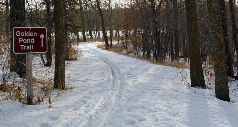
Path in winter at Rydell Refuge. Photo by USFWS.

Waterfowl enjoying the refuge. Photo by USFWS.
Location: Refuge trails S of US 2 on CR 210 between Erskine & Mentor.
- States: Minnesota
- Counties: Polk
The 7.5-mile trail system showcases wildlife habitats that developed from the "fire shadow" effects of Maple Lake. This westernmost extent of maple-Basswood forest in Minnesota shrouds the rolling landscape of glacially formed hills and wetlands. This is the stage for visitors to experience a tranquil view of wildlife habitats found on the Refuge. Trails are open to hiking, biking, and cross-country skiing.
Visitor Center open weekdays 8:00 am - 4:00 pm. Extended summer hours. Contact Rydell National Wildlife Refuge for current Visitor Center hours. Asphalt and Gravel trails are ADA Accessible.
Accessibility Information
No text provided.
Allowed Uses:
Dogs, on leash Hiking/WalkingOther Activities
- Fishing
Public Contact
David BennettUSFWR
17788 349th St. SE
Erskine, MN 56535
[email protected] • (218) 687-2229
Contact the trail manager for current maps and visiting details.
More Details
- Elevation (low): 1175
- Elevation (high): 1230
- Elevation (cumulative): --
- Part of a Trail System? No
- Surface (primary): Paved
- Surfaces (additional): Rock, crushed
- Tread Width (average): 96"
- Tread Width (minimum): --
- Running length (minimum): --
- Tread Grade (average, percent): 2
- Tread Grade (maximum): 5
- Running length (maximum): --
- Cross-slope (average, percent): --
- Cross-slope (maximum): --
- Running length (maximum): --
- Certified as an NRT
May 31, 2005

