Salmon River Trail
check with the trail manager for updated details before visiting.
Salmon River Trail
USDA Forest Service
Backcountry Trail
- Length
14.6 miles
- Elevation Gain
--
- Route Type
out & back
- Length
14.6 miles - Elevation Gain
-- - Route Type
out & back
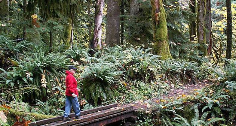
This trail accesses the Salmon-Huckleberry Wilderness and travels through mossy old-growth forests next to the wild and scenic Salmon River.

Photo by Ken Squiers.

Photo by Ken Squires.

Tree Fungus. Photo by Ken Squires.

Toadstool. Photo by Ken Squires.

Crawfish. Photo by Ken Squires.

Photo by Ken Squires.

Photo by Ken Squires.


Photo by Ken Squiers.

Photo by Ken Squiers.
Location: Backcountry/Wilderness, Salmon River Road.
- States: Oregon
- Counties: Clackamas
This trail accesses the Salmon-Huckleberry Wilderness and travels through mossy old-growth forests next to the wild and scenic Salmon River. Chinook and Coho salmon, along with Steelhead, Rainbow, and Cutthroat trout are found in the river. There are several established campsites along the way for backpackers.
The trail begins at Salmon River Road and ends at Mud Creek-Forest Road 2656-380. Salmon River Trail #742 climbs along the north shoulder of Salmon River contouring in and out of side drainages.
Accessibility Information
No text provided.
Allowed Uses:
Swimming Dogs, on leash Hiking/WalkingOther Activities
- Camping
- Wildlife viewing / observation
Public Contact
Mike TippieMount Hood National Forest
16400 Champion Way
Sandy, OR 97030
(503) 668-1788
Contact the trail manager for current maps and visiting details.
More Details
- Elevation (low): --
- Elevation (high): --
- Elevation (cumulative): --
- Part of a Trail System? No
- Surface (primary): Soil
- Surfaces (additional): --
- Tread Width (average): 24"
- Tread Width (minimum): --
- Running length (minimum): --
- Tread Grade (average, percent): --
- Tread Grade (maximum):
- Running length (maximum): --
- Cross-slope (average, percent): --
- Cross-slope (maximum): --
- Running length (maximum): --
- Certified as an NRT
Dec 12, 1979

