Sam Braxton Trail
check with the trail manager for updated details before visiting.
Sam Braxton Trail
USDA Forest Service
Backcountry Trail
- Length
3.4 miles
- Elevation Gain
--
- Route Type
out & back
- Length
3.4 miles - Elevation Gain
-- - Route Type
out & back
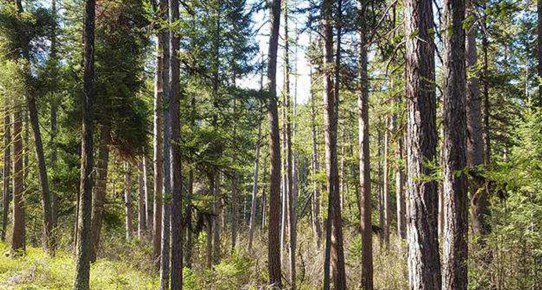
Named after a well known Missoula skier, bicyclist and outdoorsman, this trail loops around the southeast portion of Pattee Canyon Recreation Area.
Location: In Lolo NF, 5 mi. SW of Missoula on Pattee Canyon Road.
- States: Montana
- Counties: Missoula
You might want to pick up one of Lolo National Forest's Pattee Canyon brochures before exploring this trail. While the trail is signed, you can be confused easily by old horse-logging skid trails and other paths that crisscross the area.
Look for giant old-growth western larch and ponderosa pine, Montana's state tree, near the beginning of the trail. Careful observers will discover remnants of Missoula homesteads along the trail. Savor your journey into the past, but remember these artifacts are parts of archaeological sites protected by law. Leave for others to enjoy and study.
The trail begins four miles up Pattee Canyon Road, just off the south side parking area. Bear to the right beyond the gate in the parking area and follow the roadway to the trailhead.
Accessibility Information
No text provided.
Allowed Uses:
Bicycling Equestrian Hiking/Walking Snow, cross-country skiingOther Activities
- Snow, snow play general
- Wildlife viewing / observation
Public Contact
Gene ThompsonMissoula Ranger District
Missoula, MT 59804
[email protected] • (406) 329-3984
Contact the trail manager for current maps and visiting details.
More Details
- Elevation (low): 4500
- Elevation (high): 4500
- Elevation (cumulative): --
- Part of a Trail System? No
- Surface (primary): Soil
- Surfaces (additional): --
- Tread Width (average): 18"
- Tread Width (minimum): --
- Running length (minimum): --
- Tread Grade (average, percent): 12
- Tread Grade (maximum): 16
- Running length (maximum): --
- Cross-slope (average, percent): --
- Cross-slope (maximum): --
- Running length (maximum): --
- Certified as an NRT
Jan 31, 1980


