Sam Vadalabene Great River Road Bike Trail
check with the trail manager for updated details before visiting.
Sam Vadalabene Great River Road Bike Trail
State
Frontcountry Trail
Rail Trail
- Length
21.5 miles
- Elevation Gain
--
- Route Type
out & back
- Length
21.5 miles - Elevation Gain
-- - Route Type
out & back
The Sam Vadalabene Great River Road Bike Trail offers an up-close experience of the Mississippi and Illinois rivers.

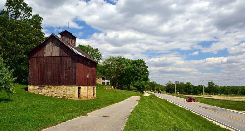
The Sam Vadalabene Bike Trail (left) and Illinois Route 100 near Pere Marquette State Park. Photo by KBH3rd.

A portion of the Sam Vadalabene Bike Trail along the Mississippi River in Madison County, Illinois. Photo by KBH3rd.
Location: Southwestern Illinois, west and south of Alton along Mississippi River opposite St. Louis.
- States: Illinois
- Counties: Jersey, Madison
The Sam Vadalabene Great River Road Bike Trail offers an up-close experience of the Mississippi and Illinois rivers. It travels at the edge of the Mississippi, tucked against the river bluffs, and then along the bank of the Illinois. It climbs and winds through the oak-hickory bluffs of the Illinois within Pere Marquette State Park. It brings the visitor to river communities: the venerable, historic city of Alton, the remarkably-preserved village of Elsah, and the revitalized river town of Grafton. The Vadalabene Trail is within the Great River Road corridor and the Meeting of the Great Rivers National Scenic Byway. It is a designated segment of the Mississippi River Trail.
The Vadalabene is exceptionally scenic. The vertical bluff river bluffs frame broad views of the river. The trail provides the bicyclist or pedestrians with a riverfront traveling experience. Part of the trail is on marked shoulders of the Great River Road and part is on a separate rail trail pathway directly adjacent. Both provide memorable river perspectives. A contrasting experience at the trail's other end takes the trail user up into the wooded river bluffs, with the challenge and accomplishment of steeper grades. Between the two is the Grafton section of the trail, which takes the trail user to shops, restaurants, and alongside the Illinois River.
Located at the northern edge of the St. Louis metropolitan area, the Vadalabene Bike Trail connects with the Confluence Trail to the Madison County system of trails and via the Clark Bridge to Missouri's Katy Trail.
Named for Illinois state senator Sam A. Vadalabene, the trail is one of the oldest in the St. Louis area, with 15 miles completed between 1976 and 1979. Senator Sam, as he was known, saw the importance of bicycling facilities long before they became common.
The trail's original 15.5-mile southeastern section is managed by the Illinois Department of Transportation. The Illinois Department of Natural Resources extended the trail to Pere Marquette State Park in the late 1980s and manages this 5-mile section. The City of Grafton developed and manages a 2-mile section within Grafton.
Accessibility Information
No text provided.
Allowed Uses:
Bicycling Dogs, on leash Hiking/Walking Snow, cross-country skiing Snow, snowshoeingOther Activities
- Snow, snow play general
- Wildlife viewing / observation
Public Contact
Illinois Dept. of Natural ResourcesOne Natural Resources Way
Springfield, IL 62702
[email protected] • (217) 782-3715
Contact the trail manager for current maps and visiting details.
More Details
- Elevation (low): 428
- Elevation (high): 496
- Elevation (cumulative): --
- Part of a Trail System? No
- National Designations: Mississippi River Trail; Meeting of the Great Rive
- Surface (primary): Paved
- Surfaces (additional): Paved
- Tread Width (average): 120"
- Tread Width (minimum): --
- Running length (minimum): --
- Tread Grade (average, percent): 2
- Tread Grade (maximum): 10
- Running length (maximum): --
- Cross-slope (average, percent): --
- Cross-slope (maximum): --
- Running length (maximum): --
- Certified as an NRT
May 31, 2006

