San Antonio River Trail
This information is a public record of the 1977 NRT application and may be out of date if it has not been updated by a trail manager --
check with the trail manager for updated details before visiting.
check with the trail manager for updated details before visiting.
San Antonio River Trail
City, Town, or County
Frontcountry Trail
- Length
8 miles
- Elevation Gain
--
- Route Type
out & back
- Length
8 miles - Elevation Gain
-- - Route Type
out & back

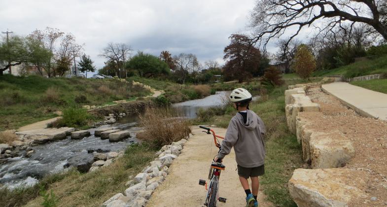
A trail ford on the San Antonio River in the King Williams Historic District just south of downtown San Antonio, Texas. Photo by Chris Sheffield.

The Riverwalk coated in snow during the 2021 winter storm. Photo by David Bemporad.

A cypress tree in autumn along the San Antonio River in the King Williams Historic District just south of downtown San Antonio. Photo by Chris Sheffield.
Location: In San Antonio, follows San Antonio R S from I-35 Mission La Espada
- States: Texas
No text provided.
Accessibility Information
No text provided.
Allowed Uses:
Bicycling Hiking/WalkingPublic Contact
San Antonio Parks and Recreation DepartmentP.O. Box 9066
San Antonio, TX 78285
Contact the trail manager for current maps and visiting details.
More Details
- Elevation (low): --
- Elevation (high): --
- Elevation (cumulative): --
- Part of a Trail System? No
- Surface (primary): Paved
- Surfaces (additional): Paved
- Tread Width (average): 0"
- Tread Width (minimum): --
- Running length (minimum): --
- Tread Grade (average, percent): --
- Tread Grade (maximum):
- Running length (maximum): --
- Cross-slope (average, percent): --
- Cross-slope (maximum): --
- Running length (maximum): --
- Certified as an NRT
Mar 17, 1977

