San Gabriel River Trails
check with the trail manager for updated details before visiting.
San Gabriel River Trails
City, Town, or County
Urban Trail
- Length
6.6 miles
- Elevation Gain
--
- Route Type
out & back
- Length
6.6 miles - Elevation Gain
-- - Route Type
out & back
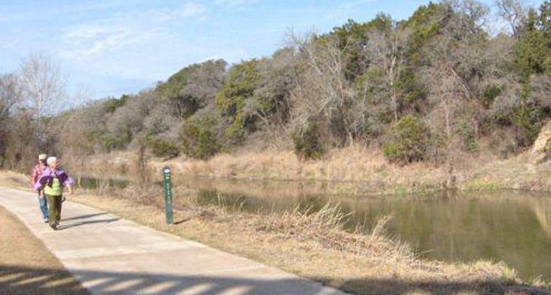
The San Gabriel River Trail is 6.6 miles long and follows the scenic North and South San Gabriel Rivers.
Location: In Georgetown follows to San Gabriel R connecting Lake Georgetown to Chautauqua Park.
- States: Texas
- Counties: Williamson
The San Gabriel River Trail is 6.6 miles long and follows the scenic North and South San Gabriel Rivers. The trail is eight feet wide and comprised of mixed surfaces including crushed granite, concrete, and asphalt. Along the trail, you can see natural springs, historic features, and animal tracks. The trail connects to the United States Corp of Engineers trails at Lake Georgetown. Some interesting sites along the trail include the star gazing area, bird watching area, and the historic Blue Hole Park. Trail users have said that the trail is very beautiful and unique to the area and even better than Town Lake in Austin. The trail system's total cost was $3 million with grants from Texas Parks and Wildlife, Lower Colorado River Authority, and the Chandler Foundation.
Accessibility Information
No text provided.
Allowed Uses:
Bicycling Dogs, on leash Hiking/WalkingOther Activities
- Fishing
Public Contact
Randy MorrowCity of Georgetown
PO Box 409
Georgetown, TX 78626
[email protected] • (512) 930-3595
Contact the trail manager for current maps and visiting details.
More Details
- Elevation (low): 680
- Elevation (high): 715
- Elevation (cumulative): --
- Part of a Trail System? No
- Surface (primary): Paved
- Surfaces (additional): Paved, Rock, crushed
- Tread Width (average): 96"
- Tread Width (minimum): --
- Running length (minimum): --
- Tread Grade (average, percent): 2
- Tread Grade (maximum): 5
- Running length (maximum): --
- Cross-slope (average, percent): --
- Cross-slope (maximum): --
- Running length (maximum): --
- Certified as an NRT
May 31, 2006


