Santa Ana River Trail, Orange County
check with the trail manager for updated details before visiting.
Santa Ana River Trail, Orange County
City, Town, or County
- Length
29 miles
- Elevation Gain
--
- Route Type
out & back
(1 review)
- Length
29 miles - Elevation Gain
-- - Route Type
out & back
The trail starts in Huntington Beach at the intersection of the Huntington Beach Bike Trail and goes through the cities of Costa Mesa, Fountain Valley, and Santa Ana.

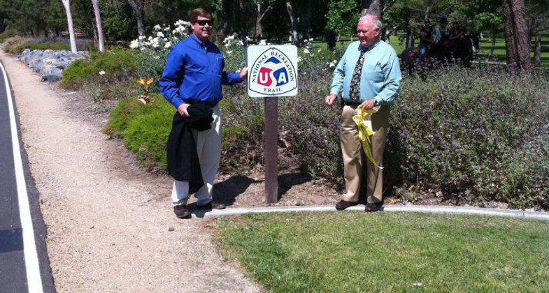
Santa Ana River Trail at the NRT designation ceremony. Photo by Orange County Parks.

OC Parks Director Mark Denny and Orange County Supervisor Bill Campbell, Third District at designation cermony. Photo by Orange County Parks.
Location: Follows Santa Ana River N from Coastal Hwy 1 to Anaheim.
- States: California
- Counties: Orange
The trail starts in Huntington Beach at the intersection of the Huntington Beach Bike Trail and goes through the cities of Costa Mesa, Fountain Valley, and Santa Ana.
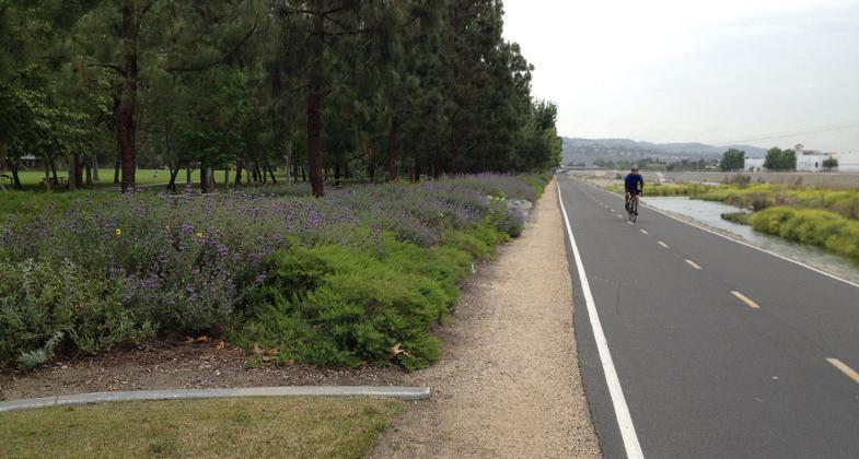
The Santa Ana River Trail is a 31.2-mile-long system of paved and unpaved pathways that extends from Huntington Beach to Corona in Southern California. The trail follows alongside the channel for the river and then through the natural areas adjacent to the river. The route takes it past local parks and schools and it serves as a way for inland residents to get to the beach without having to deal with traffic.
The trail goes past commercial districts, residential neighborhoods, golf courses, office parks, industrial complexes, and wetlands. The trail crosses numerous major roadways, but there are underpasses at most of the intersections. There is an elevation change of 400 feet along the entire route of the trail.
Accessibility Information
No text provided.
Reviews
Mark Schneider
Daytime use only
It has been years since my last Bicycle ride from Garden Grove to the north Trailhead and back but it was very enjoyable before 2015. Currently, I have a Schwinn Hybrid 28" and will be pacing myself at least weekly but I am 60.
Allowed Uses:
Hiking/WalkingPublic Contact
Jeff DickmanOrange County Public Facilities & Resources
300 North Flower St.
Santa Ana, CA 92703
(714) 834-5372
Contact the trail manager for current maps and visiting details.
More Details
- Elevation (low): --
- Elevation (high): --
- Elevation (cumulative): --
- Part of a Trail System? No
- Surface (primary): --
- Surfaces (additional): --
- Tread Width (average): 0"
- Tread Width (minimum): --
- Running length (minimum): --
- Tread Grade (average, percent): --
- Tread Grade (maximum):
- Running length (maximum): --
- Cross-slope (average, percent): --
- Cross-slope (maximum): --
- Running length (maximum): --
- Certified as an NRT
Mar 11, 1976


