Santa Ana River Trail, Riverside County
This information is a public record of the 1976 NRT application and may be out of date if it has not been updated by a trail manager --
check with the trail manager for updated details before visiting.
check with the trail manager for updated details before visiting.
Santa Ana River Trail, Riverside County
City, Town, or County
Urban Trail
- Length
10 miles
- Elevation Gain
--
- Route Type
out & back
- Length
10 miles - Elevation Gain
-- - Route Type
out & back

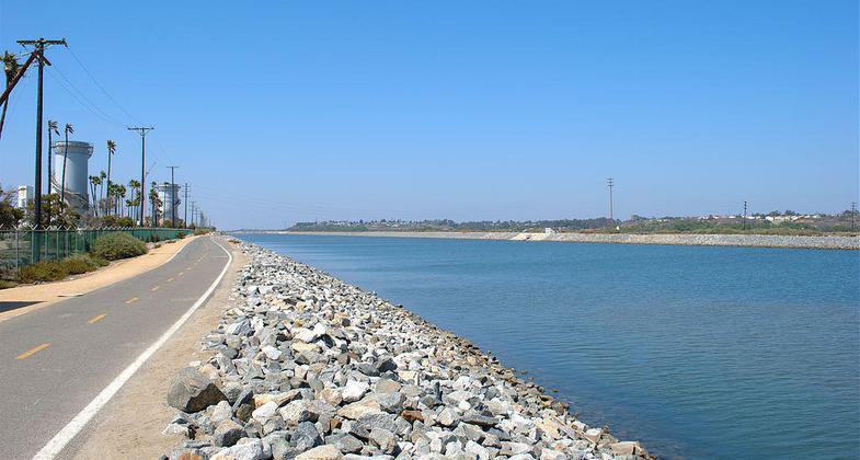
Santa Ana River looking upstream near the river mouth. Bike and pedestrian path to left. Photo by Basar.

Santa Ana River Trail. Photo by Nandaro.

Santa Ana River Trail. Photo by Nandaro.
Location: Just W of Riverside follows Santa Ana River from Mt. Roubidoux W to Adams Ave.
- States: California
- Counties: Riverside
The Santa Ana River Trail is a 20-mile-long paved path that follows the riverbed of the Santa Ana River through Riverside and Colton in Southern California. The trail has exposure to the natural areas along the riverbed, has very few street crossings, goes past multiple parks along the way, and has underpasses for crossing the major intersections.
Accessibility Information
No text provided.
Allowed Uses:
Bicycling Hiking/WalkingPublic Contact
Riverside County Regional Park and Open Space Dist4600 Crestmore Road
Riverside, CA 92509
(800) 234-7275
www.riversidecountyparks.org
Contact the trail manager for current maps and visiting details.
More Details
- Elevation (low): --
- Elevation (high): --
- Elevation (cumulative): --
- Part of a Trail System? No
- Surface (primary): --
- Surfaces (additional): --
- Tread Width (average): 0"
- Tread Width (minimum): --
- Running length (minimum): --
- Tread Grade (average, percent): --
- Tread Grade (maximum):
- Running length (maximum): --
- Cross-slope (average, percent): --
- Cross-slope (maximum): --
- Running length (maximum): --
- Certified as an NRT
Nov 2, 1976

