Schockaloe Trail
check with the trail manager for updated details before visiting.
Schockaloe Trail
USDA Forest Service
- Length
23 miles
- Elevation Gain
--
- Route Type
out & back
(1 review)
- Length
23 miles - Elevation Gain
-- - Route Type
out & back
The Shockaloe Trail is a nationally recognized trail and is listed in the National Register of Trails.
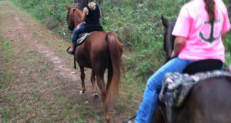
Young equestrians enjoying a ride on the trail. Photo by Donna Phillips.


Water issues

Location: In Bienville NF, NE of Forest, MS, accessed from Base Camps 1 and 2.
- States: Mississippi
The Shockaloe Trail is a nationally recognized trail and is listed in the National Register of Trails. A trip along the trail allows the rider or hiker to view more than 60 years of forest management practices in the area. Some notable items of interest are sound timber and prescribed fire management practices, superior trees, flatland hardwoods, wildlife openings and watering holes, and endangered species.
Accessibility Information
No text provided.
Reviews
Patricia Ellis
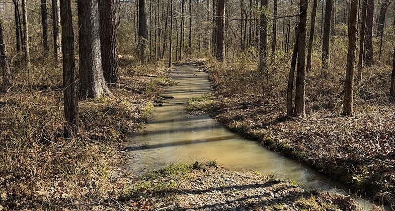
Needs drainage work
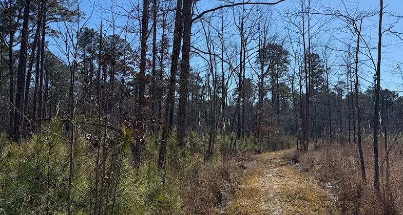
Hiked 18 miles of the 22-mile Shockaloe NRT yesterday, January 20, 2025. Actually, four miles of that was adjacent rural road to avoid massive miles of bog. This trail was primarily made for equestrian use and is the second oldest NRT ever designated according to an area sign…and since its designation I don’t think anything has been done to fix drainage issues. The trail was easy when I started on an extremely cold morning. Temps in the low 20s meant the trail was frozen and firm. As the day progressed, the ground warmed, and by mile 13 I was fighting through constant sucking mud and standing water. Reached a point where I couldn’t continue without losing my shoes and bailed through some thorns to a nearby road. Took the local roads back to my car while fending off aggressive neighborhood dogs with a fallen tree branch. I rate this as a three since the trail is easy to follow, and maybe the soft ground and deep mud is okay for horses? I have no idea. For a hiker, this trail was not doable once the ground warmed past the freezing point. If this was a hiker-only trail, I’d give it a two for the constant shoe-sucking mud and water issues. Using the roads to get back to your car is also a bit harrowing because of multiple dogs leaving their property and coming out onto the road.
Allowed Uses:
Hiking/WalkingPublic Contact
Bienville National Forest100 West Capitol St.
Jackson, MS 36269
Contact the trail manager for current maps and visiting details.
More Details
- Elevation (low): --
- Elevation (high): --
- Elevation (cumulative): --
- Part of a Trail System? No
- Surface (primary): --
- Surfaces (additional): --
- Tread Width (average): 0"
- Tread Width (minimum): --
- Running length (minimum): --
- Tread Grade (average, percent): --
- Tread Grade (maximum):
- Running length (maximum): --
- Cross-slope (average, percent): --
- Cross-slope (maximum): --
- Running length (maximum): --
- Certified as an NRT
Feb 13, 1969