Scottsboro City Park Walking Trail
check with the trail manager for updated details before visiting.
Scottsboro City Park Walking Trail
City, Town, or County
Backcountry Trail
Urban Trail
- Length
0.75 miles
- Elevation Gain
--
- Route Type
out & back
(1 review)
- Length
0.75 miles - Elevation Gain
-- - Route Type
out & back
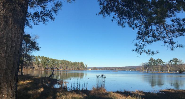
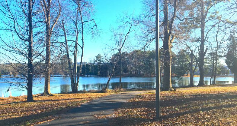
The Scottsboro City Park Walking Trail hugs the shores of the Tennessee River/Guntersville Lake with a constant view of the lake. The trail varies little in elevation, making it ideal for a very leisurely walk through partially cleared land.

Prime location to take in scenic lake views and observe waterfowl. Photo by Donna Kridelbaugh. Photo by Jim Olyniec

The walking trail is located within Scottsboro City Park. Photo by Donna Kridelbaugh.

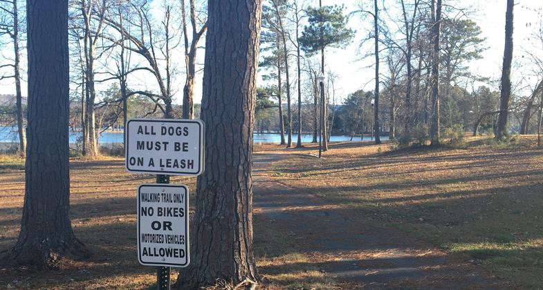
The paved trail is open to pedestrians only. Photo by Donna Kridelbaugh.

The trail is illuminated with street lamps at dark. Photo by Donna Kridelbaugh.

Entrance to the trail near the picnic pavilion. Photo by Donna Kridelbaugh.

Looking out at the water

Looking back on trail and water

Trail past trees

Trail along water

Trail beginning at trailhead
Location: 1247 Winn Road, Scottsboro, AL 35769
- States: Alabama
- Counties: Jackson
- Cities/Townships: Scottsboro
The Scottsboro City Park Walking Trail is located on an 18-acre public park facility owned by the City of Scottsboro. The trail is nearly a mile long, one-way, and 6 feet wide. It winds along the shores of the Tennessee River/Guntersville Lake. It offers daily visitors an opportunity to exercise and enjoy the scenic and quiet beauty of the area. Picnic benches are located partially along the way and are convenient to parking. Trailhead parking makes the trail convenient for a leisurely walk or a more vigorous run. The trail was constructed in 2003 with an addition in 2006, both with Recreational Trails Program grants.
Accessibility Information
No text provided.
Reviews
Donna Kridelbaugh
NRT Ambassador Review
Scottsboro City Park Walking Trail is a 0.75-mile, in-and-out paved trail (1.5 miles roundtrip) located in a residential area of town. The trail starts at the picnic pavilion towards the peninsular end of the city park. It parallels the shoreline of Guntersville Lake, takes a slight detour along a pedestrian walkway on Winn Rd., and then re-enters a partially wooded area next to the lake. The trail terminates at the back of private property. The entire trail is illuminated with street lamps while dark. The city park also has fishing piers, boat ramps and picnic areas. This trail offers residents a daily exercise destination or a respite for travelers needing to stretch their legs. It's a prime location to take in scenic lake views and observe waterfowl. The city park is open 4 a.m. to 10 p.m. each day. Please remember to Leave No Trace while out on the trail (e.g., carry out your trash, observe wildlife from a distance).
Allowed Uses:
Dogs, on leash Hiking/WalkingOther Activities
- Fishing
- Wildlife viewing / observation
Public Contact
City of ScottsboroParks and Recreation
Scottsboro, AL 35768
(256) 259-0999
+http://cityofscottsboro.com/index.php/city-park
Contact the trail manager for current maps and visiting details.
More Details
- Elevation (low): 605
- Elevation (high): 610
- Elevation (cumulative): --
- Part of a Trail System? No
- Surface (primary): Paved
- Surfaces (additional): --
- Tread Width (average): 72"
- Tread Width (minimum): 72
- Running length (minimum): --
- Tread Grade (average, percent): 2
- Tread Grade (maximum): 4
- Running length (maximum): --
- Cross-slope (average, percent): 1
- Cross-slope (maximum): --
- Running length (maximum): --
- Certified as an NRT
May 29, 2012


