Scout's Trail
check with the trail manager for updated details before visiting.
Scout's Trail
State
Backcountry Trail
- Length
4.6 miles
- Elevation Gain
--
- Route Type
out & back
(1 review)
- Length
4.6 miles - Elevation Gain
-- - Route Type
out & back
The Scout's Trail is located within Fort Abraham Lincoln State Park.


Trail by Block houses. Photo by Wendy Schmeichel.

Over of a couple trails. Photo by Wendy Schmeichel.
Location: Fort Abraham Lincoln, At Fort Abraham Lincoln State Park southwest of Bismarck.
- States: North Dakota
- Counties: Morton
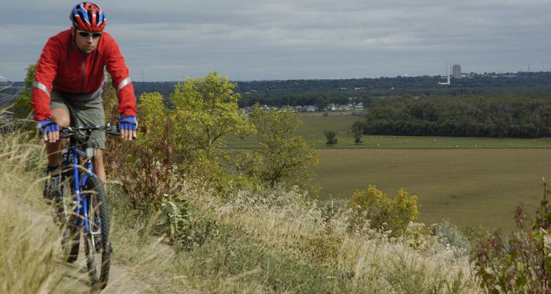
The Scout's Trail is located within Fort Abraham Lincoln State Park. The park is home to the Fort Abraham Lincoln Calvary and Infantry posts, as well as the Custer House. Interpretive opportunities abound for Native American culture, military history, the geology of the Missouri and Heart Rivers, native prairie, wildlife, and transportation on the Missouri.
The Lewis and Clark Expedition camped in this area on October 20, 1804, and their journal referenced the abandoned Mandan "On-a-Slant Village", which is located within the park. This trail will connect to the 37-mile paved trail system of Bismarck and Mandan. Fort Abraham Lincoln State Park offers modem campgrounds, camping cabins, comfort stations, and food and horse concessions. Interpretation is one of the main components of the visitor's experience at the park, with a series of interpretive signs, guided tours, living history displays, and special events. At least three parking lots are directly adjacent to the trail for users to access.
NRT Ambassador Notes: The main trails are good but the connecting trails could use signage & better maintenance. None of the trail is marked as a national recreation trail. It is not mentioned in any of the information provided or along the routes.
Accessibility Information
No text provided.
Reviews
Wendy Schmeichel
Scout's Trail
This is a very scenic group of trails. No matter which section you take, you will have a great hike. Some of the smaller connecting trails are a little hard to find.
Allowed Uses:
Bicycling Dogs, on leash Equestrian Hiking/WalkingOther Activities
- Wildlife viewing / observation
Public Contact
Marc BrownNorth Dakota Parks & Rec Dept
, [email protected] • (701) 328-5354
www.parkrec.nd.gov
Contact the trail manager for current maps and visiting details.
More Details
- Elevation (low): 1760
- Elevation (high): 1900
- Elevation (cumulative): --
- Part of a Trail System? No
- National Designations: Legacy Millenium
- Surface (primary): Soil
- Surfaces (additional): Soil
- Tread Width (average): 18"
- Tread Width (minimum): --
- Running length (minimum): --
- Tread Grade (average, percent): 8
- Tread Grade (maximum): 12
- Running length (maximum): --
- Cross-slope (average, percent): --
- Cross-slope (maximum): --
- Running length (maximum): --
- Certified as an NRT
May 31, 2008

