Shadow of the Sentinels
This information is a public record of the 1979 NRT application and may be out of date if it has not been updated by a trail manager --
check with the trail manager for updated details before visiting.
check with the trail manager for updated details before visiting.
Shadow of the Sentinels
USDA Forest Service
Backcountry Trail
- Length
0.5 miles
- Elevation Gain
--
- Route Type
out & back
- Length
0.5 miles - Elevation Gain
-- - Route Type
out & back
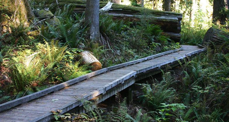
A fully accessible trail amidst old growth forest.

Accessible boardwalk on the Shadow of the Sentinels National Recreation Trail in Baker-Snoqualmie National Forest, WA. Photo by American Trails.
Location: T37N, R8E, Sec. 25, in Baker-Snoqualmie National Forest, off Forest Hwy 25, W of Horseshoe Cove on Baker Lake.
- States: Washington
- Counties: Whatcom
Shadow of the Sentinels Trail #623 is an accessible interpretive trail winding through dense forest growth. Huge Douglas fir and cedar trees tower above a forest floor of ferns, moss, and berry bushes. Signs along the route explain the dynamics of this 500-year-old forest. The trail is built of asphalt and boardwalks with grades no greater than 8 percent.
Accessibility Information
No text provided.
Allowed Uses:
Hiking/WalkingPublic Contact
Lief HazeletUSDA Forest Service
810 SR 20
Sedro Woolley, WA 98284
[email protected] • (206) 856-5700
www.fs.fed.us/r6/mb
Contact the trail manager for current maps and visiting details.
More Details
- Elevation (low): 900
- Elevation (high): 900
- Elevation (cumulative): --
- Part of a Trail System? No
- Surface (primary): Paved
- Surfaces (additional): Paved
- Tread Width (average): 36"
- Tread Width (minimum): --
- Running length (minimum): --
- Tread Grade (average, percent): --
- Tread Grade (maximum): 2
- Running length (maximum): --
- Cross-slope (average, percent): --
- Cross-slope (maximum): --
- Running length (maximum): --
- Certified as an NRT
Oct 4, 1979

