Shell Falls
check with the trail manager for updated details before visiting.
Shell Falls
USDA Forest Service
Backcountry Trail
- Length
0.2 miles
- Elevation Gain
--
- Route Type
out & back
(1 review)
- Length
0.2 miles - Elevation Gain
-- - Route Type
out & back
Shell Falls Interpretive Site is located on U.S. Highway 14, 21 miles southwest of Burgess Junction, Wyoming.
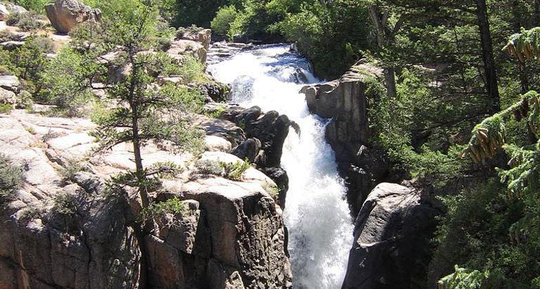
Shell Falls in Wyoming. Photo by Liz Lawley.
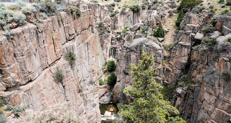
Shell Falls - 7-17-18. Photo by Jim Walla.
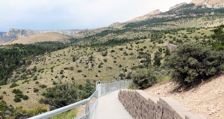
Shell Falls - 7-17-18. Photo by Jim Walla.
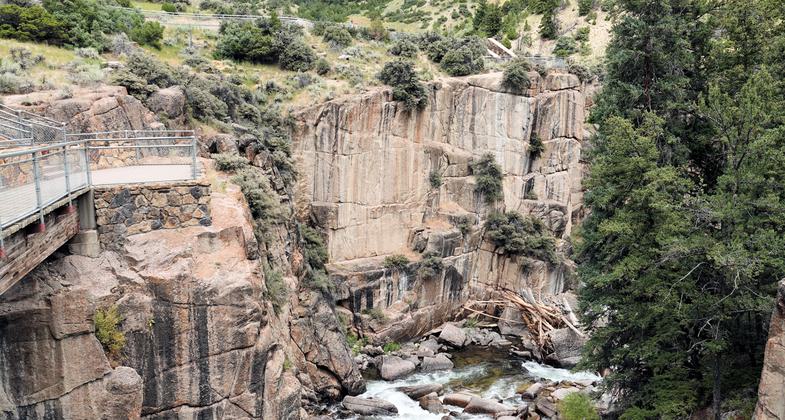
Shell Falls - 7-17-18. Photo by Jim Walla.
Location: Along US 14 21.5 mi. E of Greybill.
- States: Wyoming
Over the past million years, Shell Creek has incised a deep chasm through the sedimentary stone and ancient granite. The water of Shell Falls, dropping at a rate of 3,600 gallons per second, follows fractures in the resistant granite. Shell Canyon is named for the shell fossils found in the sedimentary canyon walls.
Shell Falls Interpretive Site is located on U.S. Highway 14, 21 miles southwest of Burgess Junction, Wyoming. The site is open from 9:30 a.m. to 5:00 p.m., seven days a week, Memorial Day through mid-September.
Accessibility Information
No text provided.
Reviews
Jim Walla
Shell Falls - 7-17-18
Shell Falls is in Bighorn National Forest. I likely would not have stopped in, but I was driving the Bighorn National Forest Scenic Byway and it was a convenient place to stop and stretch my legs. I'm glad I stopped, it was a very pleasant surprise. The trail is basically a sidewalk, so it is easy and accessible. It is concrete with a chain link fence protecting you from the cliffs along the way. The whole facility looked very new so everything was clean and in excellent shape. The description says 0.2 miles. However, if you go down all the little side spurs to the overlooks, I believe you will walk closer to 1/2 mile. The views were pretty diverse for such a short trail: views down into canyons with waterfalls and panoramic views of mountains in the distance. The wow factor to effort ratio is very good! Excellent views for very little effort.
Allowed Uses:
Hiking/WalkingPublic Contact
Joel B. StrongBighorn National Forest
1969 South Sheridan St.
Sheridan, WY 82801
(307) 672-0751
Contact the trail manager for current maps and visiting details.
More Details
- Elevation (low): --
- Elevation (high): --
- Elevation (cumulative): --
- Part of a Trail System? No
- Surface (primary): --
- Surfaces (additional): --
- Tread Width (average): 36"
- Tread Width (minimum): --
- Running length (minimum): --
- Tread Grade (average, percent): --
- Tread Grade (maximum):
- Running length (maximum): --
- Cross-slope (average, percent): --
- Cross-slope (maximum): --
- Running length (maximum): --
- Certified as an NRT
Dec 12, 1979

