Sheltowee Trace
check with the trail manager for updated details before visiting.
Sheltowee Trace
USDA Forest Service
Backcountry Trail
- Length
269 miles
- Elevation Gain
--
- Route Type
out & back
- Length
269 miles - Elevation Gain
-- - Route Type
out & back
The Sheltowee Trace Trail National Recreation Trail was created in 1976 and stretches from the Leather Wood Trail Head in the Big South Fork National River and Recreation Area in Tennessee to northern Rowan County, Kentucky.

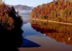
Image courtesy U.S. Army Corps of Engineers.

Trudging the trail together at Red River Gorge. Photo by David Kravetz, Sumoflam Produc.
Location: Daniel Boone National Forest, Spans the length of the Daniel Boone NF with many access points at highway crossings (S to N) State Route 92, U.S. Highway 27, State Route 80, I-75, U.S. Highway 421, State Route 402, U.S. Highway 460, U.S. Highway 60, I-64.
- States: Kentucky
- Counties: Rowan, Bath, Menifee, Powell
The Sheltowee Trace Trail National Recreation Trail was created in 1976 and stretches from the Leather Wood Trail Head in the Big South Fork National River and Recreation Area in Tennessee to northern Rowan County, Kentucky. The trail is named after Daniel Boone, who was given the name Sheltowee, meaning Big Turtle when he was adopted as the son of the great warrior Chief Blackfish of the Shawnee tribe.
The trail is mostly in the Daniel Boone National Forest but also takes visitors through the Big South Fork National River and Recreation Area, Cumberland Falls State Resort Park, Natural Bridge State Resort Park, two large recreation lakes (Cave Run Lake and Laurel Lake), and many wildlife management areas. All but the southernmost 10 miles (16.09 km) are in Kentucky.
The trail may be multi-use, in certain sections, allowing horses, mountain bikes, and off-road vehicles in some designated sections. Using Off-road motorcycles, SUVs, 4x4, ATVs, and even mountain bikes in certain areas can result in equipment confiscation and/or fines. While the southern terminus was moved in 2013, the trail into Pickett State Park remains open for those that wish to exit on that trail or wish to walk further down the scenic Rock Creek.
Accessibility Information
No text provided.
Allowed Uses:
Bicycling Equestrian Motorized vehicles, – ATV/ORV Motorized vehicles, – four-wheel driveOther Activities
- Fishing
Public Contact
Steve BarbourSheltowee Trace Association
P.O. Box 360
Livingston, KY 40445
[email protected] • (606) 386-3636
www.sheltoweetrace.org
Contact the trail manager for current maps and visiting details.
More Details
- Elevation (low): 700
- Elevation (high): 1400
- Elevation (cumulative): --
- Part of a Trail System? No
- National Designations: National Millenium
- Surface (primary): Soil
- Surfaces (additional): --
- Tread Width (average): 24"
- Tread Width (minimum): --
- Running length (minimum): --
- Tread Grade (average, percent): 12
- Tread Grade (maximum):
- Running length (maximum): --
- Cross-slope (average, percent): --
- Cross-slope (maximum): --
- Running length (maximum): --
- Certified as an NRT
Jun 21, 1979

