Shut-In Trail
check with the trail manager for updated details before visiting.
Shut-In Trail
USDA Forest Service
Backcountry Trail
- Length
16.3 miles
- Elevation Gain
--
- Route Type
out & back
- Length
16.3 miles - Elevation Gain
-- - Route Type
out & back
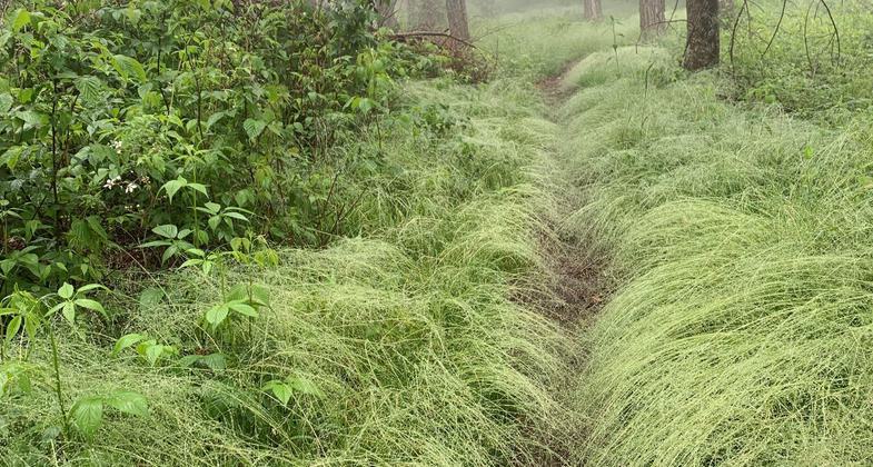
The Shut-in Trail was probably named for the thick rhododendron thickets that make the hiker feel "shut in".

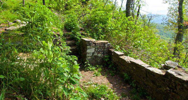
Remants of the Buck Spring Lodge on the Shut-In Trail. Photo by Ken Hurley.

Rhodo tunnels with color on the Shut-In. Photo by Tara Malone.

Trail Guides on the Shut-In. Photo by Tara Malone.

Blue Ridge Mood on the Shut-In. Photo by Tara Malone.
Location: Pisgath Road Near Asheville along the Blue Ridge Parkway between mileposts 393.8 and 407.4. (recertified 1992)
- States: North Carolina
- Counties: Buncombe
George Vanderbilt constructed it in the 1890s for the purpose of reaching his Buck Spring Hunting Lodge from the Biltmore House. (The remnants of the lodge are near the Buck Spring Gap Overlook.) Since that time, this route has been converted to a hiking trail and is now a part of the Mountains-to-Sea Trail (#440, white dot blazes). In 16.3 miles, the trail changes elevation by almost 3,000 feet, and in places can be quite challenging. Except where the trail crosses the Parkway, it is a quiet walk through beautiful hardwood forests with many nice views of the valleys below. Despite its proximity to the Parkway, this trail does not receive much use, particularly along its southern reaches.
Approximate Elevation Change: 2,700 feet. Blaze: White.
Accessibility Information
No text provided.
Allowed Uses:
Hiking/WalkingPublic Contact
Jeff OwenbyUS Forest Service
1001 Pisgah Hwy.
Pisgah Forest, NC 28760
[email protected] • (828) 877-3130
Contact the trail manager for current maps and visiting details.
More Details
- Elevation (low): 3000
- Elevation (high): 5000
- Elevation (cumulative): --
- Part of a Trail System? No
- Surface (primary): Soil
- Surfaces (additional): Soil
- Tread Width (average): 18"
- Tread Width (minimum): --
- Running length (minimum): --
- Tread Grade (average, percent): 8
- Tread Grade (maximum): 20
- Running length (maximum): --
- Cross-slope (average, percent): --
- Cross-slope (maximum): --
- Running length (maximum): --
- Certified as an NRT
Nov 26, 1981


