Silver Comet Trail
check with the trail manager for updated details before visiting.
Silver Comet Trail
City, Town, or County
Urban Trail
- Length
61.5 miles
- Elevation Gain
--
- Route Type
out & back
- Length
61.5 miles - Elevation Gain
-- - Route Type
out & back
This rail trail serves as a significant connection between urban Marietta and surrounding neighborhoods, numerous side trails, and the 105-acre Heritage Park.

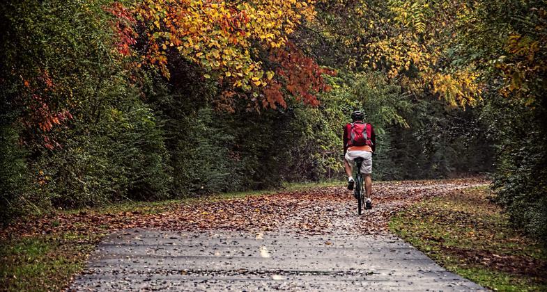
A bicyclist on a beautiful autumn day. Photo by Clara Williams.

Fall bike ride Silver Comet Trail, Hiram, Ga. Photo by Sherry Stover.

Wooded area. Photo by John Terrill.

One of the trail's many foot bridges. Photo by John Terrill.

The 'Last Foot of Trail' marker, denoting the last completed foot of trail in the final segment of the Silver Comet Trail. Photo by Don Sullivan.

The State Line Gateway welcomes trail users to the State of Georgia on the Silver Comet Trail, near Cedartown, GA. Photo by Don Sullivan.


A panning shot of a bicyclist on the Silver Comet Trail. Photo by Clara Williams.
Location: Smyrna, GA to Georgia/Alabama State Line
- States: Georgia
- Counties: Cobb, Paulding, Polk
This rail trail serves as a significant connection between urban Marietta and surrounding neighborhoods, numerous side trails, and the 105-acre Heritage Park, and connects at the Alabama state line to the 33-mile long Chief Ladiga Trail. This multi-use trail provides access to significant natural beauty that is unusual in metropolitan areas. Amidst historic woolen mills and scenic vistas, this rail trail allows for recreational activities such as biking, jogging, hiking, and horseback riding.
Accessibility Information
No text provided.
Allowed Uses:
Dogs, on leash Hiking/WalkingPublic Contact
Rusty SimpsonCobb County Parks, Recreation and Cultural Affai
1792 County Services Pkwy.
Marietta, GA 30008
[email protected] • (770) 528-8840
Contact the trail manager for current maps and visiting details.
More Details
- Elevation (low): 927
- Elevation (high): 1038
- Elevation (cumulative): --
- Part of a Trail System? No
- Surface (primary): Paved
- Surfaces (additional): Paved
- Tread Width (average): 127"
- Tread Width (minimum): --
- Running length (minimum): --
- Tread Grade (average, percent): 1
- Tread Grade (maximum): 2
- Running length (maximum): --
- Cross-slope (average, percent): --
- Cross-slope (maximum): --
- Running length (maximum): --
- Certified as an NRT
May 31, 2002


