Silver Moccasin
check with the trail manager for updated details before visiting.
Silver Moccasin
USDA Forest Service
Backcountry Trail
- Length
51 miles
- Elevation Gain
--
- Route Type
out & back
- Length
51 miles - Elevation Gain
-- - Route Type
out & back
The Silver Moccasin Trail is a 53-mile trail located in the San Gabriel Mountains, northeast of Los Angeles.
Location: Los Angeles River Ranger District, Links Pacific Crest NST with Gabrielino NRT in the Angeles National Forest, northwest of Altadena and Pasadena.
- States: California
- Counties: Los Angeles
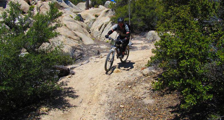
The Silver Moccasin Trail is a 53-mile trail located in the San Gabriel Mountains, northeast of Los Angeles. The trail begins at Chantry Flat Recreation Area above the city of Arcadia, California, traversing upward and down through several canyons and along the high ridges of the Angeles National Forest. This trail connects Mt. Baden-Powell, Mount Burnham, Throop Peak, and Mount Hawkins. It comes to its highest point of 9,399 feet at Mount Baden-Powell after which point it descends to its terminus at Vincent Gap on the Angeles Crest Highway near Wrightwood.
Accessibility Information
No text provided.
Allowed Uses:
Bicycling Dogs, on leash Hiking/WalkingOther Activities
- Camping
- Fishing
- Wildlife viewing / observation
Public Contact
Alberto Ortega[email protected]
Contact the trail manager for current maps and visiting details.
More Details
- Elevation (low): 2000
- Elevation (high): 9000
- Elevation (cumulative): --
- Part of a Trail System? No
- National Designations: National Millennium
- Surface (primary): Soil
- Surfaces (additional): Soil
- Tread Width (average): 28"
- Tread Width (minimum): --
- Running length (minimum): --
- Tread Grade (average, percent): 4
- Tread Grade (maximum): 10
- Running length (maximum): --
- Cross-slope (average, percent): --
- Cross-slope (maximum): --
- Running length (maximum): --
- Certified as an NRT
Aug 16, 1979


