Sixshooter Canyon
check with the trail manager for updated details before visiting.
Sixshooter Canyon
USDA Forest Service
Backcountry Trail
- Length
6 miles
- Elevation Gain
--
- Route Type
out & back
- Length
6 miles - Elevation Gain
-- - Route Type
out & back
The trail is a continuous climb through several life zones, with elevations from 4,600-7,560 ft. Splendid views of Miami/Globe and the surrounding area. Allow 4+ hours for the hike up and 3 hours down.

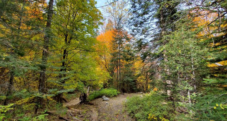
Upper Six Shooter Canyon. Photo by Chris Johnson.

View from Pinal Mountains, while on Sixshooter Canyon Trail #197. Photo by Sakhair Volk/wiki.
Location: From Globe take FS Rd. 112 to Icehouse CCC trailhead (6 mi) or Ferndell Trailhead via FS Rds. 112, 555, 651, and 651C.
- States: Arizona
- Counties: Gila
This trail begins on the east edge of the Icehouse CCC parking area, works its way out to and across the fire break, then southeast until it intersects the old homestead road a little south of the decomposed granite pit. It continues south on the road, which eventually becomes more of a trail until it intersects the Pioneer Pass Road/Forest Road (FR) 112. After crossing FR 112, the trail continues north along the creek, then up to a saddle and around a ridge along a fence line. Travelers will find an old mine shaft and the remains of a sawmill and cabin at the junction with Telephone Trail 192. Near the end of the trail is a fork. The right fork leads to Ferndell Trailhead, while the main trail crosses a road, climbs, and then crosses Forest Road (FR) 651C before ending at a T-intersection with Middle Trail 202.
The trail is a continuous climb through several life zones, with elevations from 4,600-7,560 ft. Splendid views of Miami/Globe and the surrounding area. Allow 4+ hours for the hike up and 3 hours down.
Accessibility Information
No text provided.
Allowed Uses:
Hiking/WalkingOther Activities
- Camping
Public Contact
Jim PayneTonto National Forest
23/24 East McDowell Rd.
Phoenix, AZ 85006
(602) 225-5200
Contact the trail manager for current maps and visiting details.
More Details
- Elevation (low): --
- Elevation (high): --
- Elevation (cumulative): --
- Part of a Trail System? No
- Surface (primary): --
- Surfaces (additional): --
- Tread Width (average): 24"
- Tread Width (minimum): --
- Running length (minimum): --
- Tread Grade (average, percent): --
- Tread Grade (maximum):
- Running length (maximum): --
- Cross-slope (average, percent): --
- Cross-slope (maximum): --
- Running length (maximum): --
- Certified as an NRT
Nov 15, 1979

