Skookum Butte
check with the trail manager for updated details before visiting.
Skookum Butte
USDA Forest Service
Backcountry Trail
- Length
1.7 miles
- Elevation Gain
--
- Route Type
out & back
- Length
1.7 miles - Elevation Gain
-- - Route Type
out & back
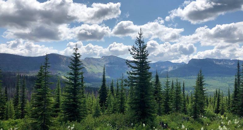
This hike is short in distance, but pretty steep, so it may take a while. The 360-degree view from the top is worth every step of the way!

Skookum Butte Trail on the Missoula Ranger District. Photo by USFS- Missoula Ranger Dist.

Two year old hiker learning to use trekking poles on local NRT. Photo by Indra Davis.
Location: Missoula Ranger District, In Lolo National Forest, 34 mi. SW of Missoula, on Elk Meadow Rd., # 451, off US Hwy. 12.
- States: Montana
- Counties: Missoula
Skookum Butte Trail (304) is a National Recreation Trail that switchbacks up to the old lookout. It features views of Lolo Creek and the Graves Range. In the winter the Elk Meadows Road is closed to vehicle traffic for snowmobile use. Then the road becomes part of the snowmobile network. This hike is short in distance, but pretty steep, so it may take a while. The 360-degree view from the top is worth every step of the way!
Accessibility Information
No text provided.
Allowed Uses:
Bicycling Motorized vehicles, snowmobiling Snow, cross-country skiing Snow, snowshoeingOther Activities
- Camping
- Snow, snow play general
- Wildlife viewing / observation
Public Contact
Charyl VanderburgMissoula Ranger District
, (406) 329-3984
Contact the trail manager for current maps and visiting details.
More Details
- Elevation (low): 5693
- Elevation (high): 7202
- Elevation (cumulative): --
- Part of a Trail System? No
- Surface (primary): Soil
- Surfaces (additional): Soil
- Tread Width (average): 12"
- Tread Width (minimum): --
- Running length (minimum): --
- Tread Grade (average, percent): 14
- Tread Grade (maximum): 37
- Running length (maximum): --
- Cross-slope (average, percent): --
- Cross-slope (maximum): --
- Running length (maximum): --
- Certified as an NRT
Jan 31, 1980

