Skookum Flats
check with the trail manager for updated details before visiting.
Skookum Flats
- Length
8 miles - Elevation Gain
-- - Route Type
out & back
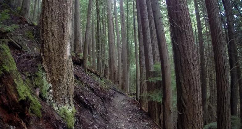
This popular trail follows the west side of the White River through the thick forest covered in moss to the main attraction: Skookum Falls. The best views of the falls are in spring during the runoff of winter snow and rain.
Location: T18N; R10E; S<apos>s6,7,8,17,20,27,34, Along SR 410 from NE corner of Mt. Rainier National Park, in the Snoqualmie National Forest.
- States: Washington
- Counties: Pierce
This popular trail follows the west side of the White River through the thick forest covered in moss to the main attraction: Skookum Falls. The best views of the falls are in spring during the runoff of winter snow and rain.
Follow the river for 2.1 miles to Skookum Falls. The best time to view the falls is from early spring to June. Continue past the falls to mile 3.1 to view rock formation, "The Palisades," across the river to the east.
Reach the junction with Buck Creek Trail 1169 at mile 4.1 and at mile 5.7 go under the concrete bridge for Buck Creek Road 7160. At mile 6.7 reach the south end of Ranger Creek Emergency Airstrip near FS road 7190. The trail ends at Mt. Rainier National Park Boundary.
Note: Much of the trail is on the river's edge and is inaccessible when the river runs high. The river banks are rearranged often with soft silt deposited into the forest that can suck you in over your boots.
Accessibility Information
No text provided.
Reviews
Jim Walla
Skookum Flats - 7-25-18
Having just finished a big hike at Mt Rainier NP, I did not have the time or energy for another long hike. So I only saw about 1/2 mile of the 8 mile Skookum Flats Trail in Snoqualmie National Forest. However, I was impressed enough with what I saw that I thought I should submit a brief review. The trail went through an old forest with huge living trees and a number of fallen trees covered in moss. It was cool and damp (great on a summer day) and the trees were spectacular. For you LOTR fans, I was half expecting to run into Treebeard at any moment. I thoroughly enjoyed the bit that I hiked. If I'm ever in that area again, I will definitely give the whole trail a look.
Allowed Uses:
Bicycling Dogs, on leash EquestrianOther Activities
- Camping
Public Contact
Bob PacificUS Forest Service
450 Roosevelt Ave E
Enumclaw, WA 98022
bpacific@fs.fed.us • (360) 825-6585
Contact the trail manager for current maps and visiting details.
More Details
- Elevation (low): 2300
- Elevation (high): 2600
- Elevation (cumulative): --
- Part of a Trail System? No
- National Designations: National Millennium
- Surface (primary): Boardwalk
- Surfaces (additional): Boardwalk, Soil
- Tread Width (average): 24"
- Tread Width (minimum): --
- Running length (minimum): --
- Tread Grade (average, percent): 10
- Tread Grade (maximum): 15
- Running length (maximum): --
- Cross-slope (average, percent): --
- Cross-slope (maximum): --
- Running length (maximum): --
- Certified as an NRT
Oct 4, 1979


