Skull Hollow Nature Trail
check with the trail manager for updated details before visiting.
Skull Hollow Nature Trail
U.S. Corps of Engineers
Backcountry Trail
- Length
2.5 miles
- Elevation Gain
--
- Route Type
Loop
- Length
2.5 miles - Elevation Gain
-- - Route Type
Loop
Three different routes are available on the Skull Hollow Nature Trail: Short Loop, Long Loop, and a Hiking Trail. This trail features not only labeled trees and shrubs but is an interpretive trail that has ten points of interest marked by numbered posts.

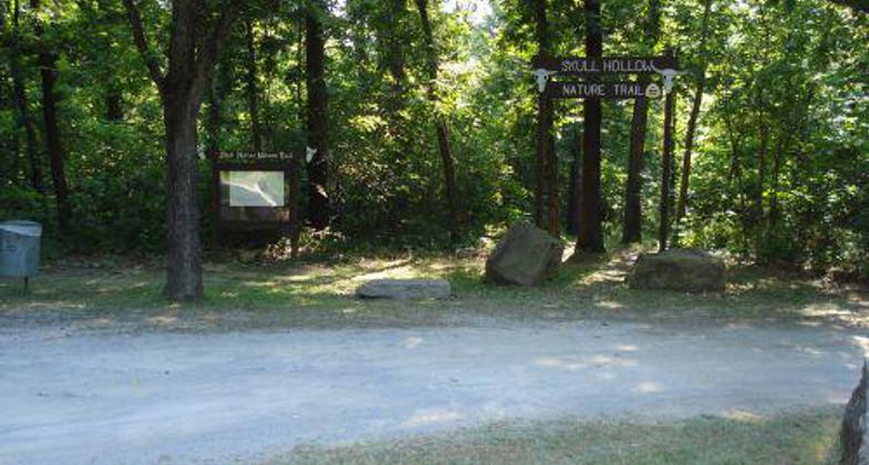
Skull Hollow Nature Trail - Trailhead.

Skull Hollow Nature Trail. Photo by Terry Brunholtz.
Location: Oologah Lake is located about 2 miles East of the town of Oologah on Highway 88 in Rogers County, Oklahoma, and about 27 miles northeast of Tulsa in Rogers County, Oklahoma.
- States: Oklahoma
- Counties: Rogers
History of Skull Hollow
Skull Hollow Nature Trail is situated in the oak-hickory woods of Northeast Oklahoma. This region was once part of the largest district in the Cherokee Indian Territory.
The name Skull Hollow came about back when the area was still Indian Territory. It seems a Texas cowman, who had a herd of cattle at Old Alluwe, came to the McDaniel Trading Post looking for some strays. Two Cherokees, Louis McNair and Dirt Pot rode in from the west and also stopped at the post, which was on the north bank of the Caney River and about four miles south of Oologah. When the cowman stopped, he noticed his horse was lame and proceeded to the blacksmith's shop to have the horse examined.
After the horse was shod, he pulled out a large roll of money, but the blacksmith could not make a change and told him to drop it by later. The cowman rode off toward his home ranch. Shortly afterward, Louis McNair and Dirt Pot started off on their horses in the same direction. The cowman mysteriously disappeared and later a skull was found in what is now known as "Skull Hollow".
Description of the Trail
Three different routes are available on the Skull Hollow Nature Trail: Short Loop, Long Loop, and a Hiking Trail.
The short loop is about a third of a mile long and has several trees and shrubs labeled along the path. It is designed for those who wish to take a brief look at an oak-hickory type forest common in this region of Oklahoma.
The long loop offers a leisurely path approximately three-quarters of a mile in length. This trail features not only labeled trees and shrubs but is an interpretive trail that has ten points of interest marked by numbered posts. These features are described below in this pamphlet.
For the adventuresome, a hiking trail a mile and a third in length is the thing. The route takes you along the bluff with excellent vantage points of the lake along the way. The trail loops back off the bluff at Skull Hollow following an old wagon road back to the starting point. An old Verdigris River horse crossing is visible leading down the bluff at this point.
We hope you enjoy whatever route you choose, and that you take the opportunity to try them all.
Accessibility Information
No text provided.
Allowed Uses:
Hiking/WalkingOther Activities
- Wildlife viewing / observation
Public Contact
Tabitha NixonUS Army Corps of Engineers
8400 E. Hwy 88
Oologah, OK 74053
[email protected] • (918) 443-2250
Contact the trail manager for current maps and visiting details.
More Details
- Elevation (low): --
- Elevation (high): --
- Elevation (cumulative): --
- Part of a Trail System? No
- Surface (primary): Soil
- Surfaces (additional): --
- Tread Width (average): 72"
- Tread Width (minimum): 36
- Running length (minimum): --
- Tread Grade (average, percent): --
- Tread Grade (maximum):
- Running length (maximum): --
- Cross-slope (average, percent): --
- Cross-slope (maximum): --
- Running length (maximum): --
- Certified as an NRT
Aug 3, 1995

