Sliding Sands
check with the trail manager for updated details before visiting.
Sliding Sands
National Park Service
- Length
7.5 miles
- Elevation Gain
--
- Route Type
out & back
- Length
7.5 miles - Elevation Gain
-- - Route Type
out & back
If you're looking for a great Haleakala summit hike then Sliding Sands Trail is the perfect trek.

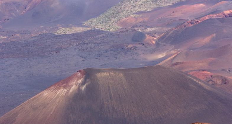
Sliding Sands Trail, Haleakala Crater. Photo by NPS.

Breathtakingly beautiful scenery every step of the way.

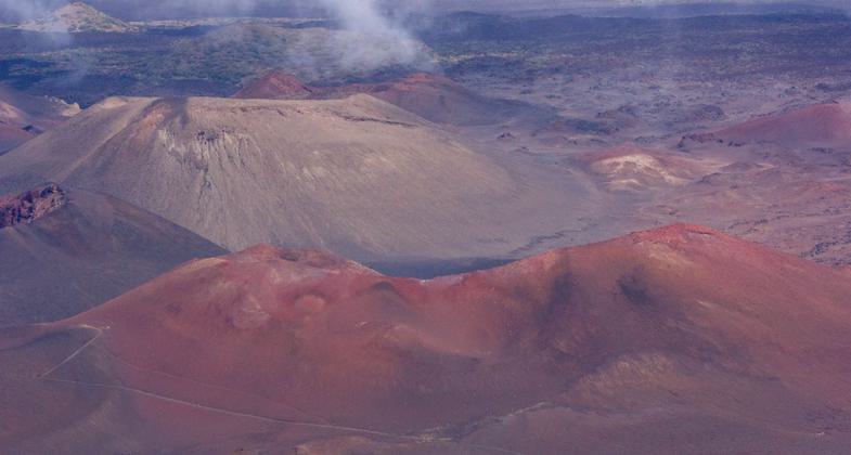
Enjoy the amazing other worldly moonscape all along the trail.

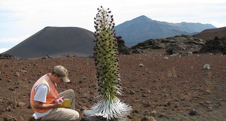
Silene struthioloides (habit). Location: Maui, Sliding Sands Haleakala National Park.

Sliding Sands trail Haleakala National Park, Maui, Hawaii. Photo by NPS.
Location: In Haleakala National Park, joins visitor center to Oili Puu cinder cone.
- States: Hawaii
This extremely strenuous trail descends 2,800 ft. in the first four miles to the valley floor. The Keoneheehee (Sliding Sands) Trail starts at the bulletin board by the entrance to the Haleakala Visitor Center parking lot. For a good half-day (and yet still moderately strenuous) hike, we recommend the first 2.5 miles of the trail to the Ka Lu'u o ka O'o cinder cone before turning around and taking the trail back out. The round trip is a 5-mile trek, and given the elevation, it'll feel like it's longer. The final climb back up Haleakala's crater rim will also be more than enough hike for one day. The total elevation gain/loss between the trailhead and the cinder cone is approximately 1,400 ft.
Accessibility Information
No text provided.
Allowed Uses:
Hiking/WalkingPublic Contact
Peter KafkaHaleakala National Park
P.O. Box 369
Makawao, HI 96768
Contact the trail manager for current maps and visiting details.
More Details
- Elevation (low): --
- Elevation (high): --
- Elevation (cumulative): --
- Part of a Trail System? No
- Surface (primary): --
- Surfaces (additional): --
- Tread Width (average): 0"
- Tread Width (minimum): --
- Running length (minimum): --
- Tread Grade (average, percent): --
- Tread Grade (maximum):
- Running length (maximum): --
- Cross-slope (average, percent): --
- Cross-slope (maximum): --
- Running length (maximum): --
- Certified as an NRT
Feb 4, 1982

