Sligo Creek Parkway Trail
check with the trail manager for updated details before visiting.
Sligo Creek Parkway Trail
State
Urban Trail
- Length
10.2 miles
- Elevation Gain
--
- Route Type
out & back
- Length
10.2 miles - Elevation Gain
-- - Route Type
out & back
The Sligo Creek Trail is a 10.2-mile hard surface trail and is one of the oldest in the County.

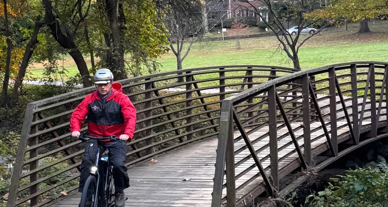
2025 Photo Contest Winner - Health and Fitness Category. Photo by Michael Jackson

Bridging Sligo Creek

Sligo Creek Trail Bridge

The Sligo Creek Trail runs through a flood plain forest

Location: Along Sligo Creek from New Hampshire Avenue (MD 650) north to Wheaton Regional Park.
- States: Maryland
- Counties: Montgomery
The Sligo Creek Trail is a 10.2-mile hard surface trail and is one of the oldest in the County. The trail is the heaviest-used facility in stream valley park and provides recreation for persons of all ages and abilities. Several paved, and unpaved, trails are scattered throughout the park and connect other park facilities, schools, and neighborhoods to the main trail. The trail starts at the Prince George's County border and continues through Montgomery County through several neighborhoods and parks and ends at Wheaton Regional Park where visitors may enjoy a variety of recreational and educational opportunities. Take a ride on a train, go horseback riding, go fishing, ice skating, tour botanical gardens, attend a nature program, and discover the park's beauty. Many of our facilities accommodate people with disabilities.
One of the many unique features of this trail is that Sligo Creek Park also has nine parks associated with the watershed and along the trail. These parks contain playgrounds, tennis and basketball courts, picnic areas softball/baseball fields, and a recreational building. The trail is located in Montgomery County, which has a population of approximately 900,000. The trail is located in the down-county area. Not only does the trail serve a large number of residents, but it serves a very diverse population including Asians, Latinos, and many other nationalities. The width of the park represents the floodplain of Sligo Creek.
In the early ages of development, most companies would not build on flood plains or steep slopes because it was not optimal land for buildings. Where there are large high-rise buildings along the park there tend to be what are called military ridges, which are steep banks covered with trees. These allow the parkgoers to enjoy the natural beauty of undeveloped nature while also allowing the apartments to have a view of the park.
There are plans underway to link the trail to the busy Silver Spring business district which will be known as the Silver Spring Green Trail. This would provide an alternative to bus/car commuters and with the proximity of the trail to so many neighborhoods, other trails, and downtown Washington D.C., this will continue to be a very popular trail with great scenery. Rob Bushnell, former chief of the Maryland Scenic and Wild Rivers Program, said the B-H-designed Sligo Creek Hiking/Biking Trail is very, very environmentally sensitive. The project was strongly supported by the Washington Area Bicyclist Association, Anacostia Headwaters Greenway, and the Coalition for the Metropolitan Branch Trail. The bikeway benefits the area in a number of ways: it encourages bicycle commuting to improve air quality, it provides local children with a safe alternative to cycling on the road that winds through Sligo Creek valley, and it leads to the greater public appreciation of Sligo Creek and the area's environmental assets.
Accessibility Information
No text provided.
Allowed Uses:
Bicycling Dogs, on leash Hiking/WalkingOther Activities
- Wildlife viewing / observation
Public Contact
John BoydM-NCPPC
8000 Meadowbrook Lane
Chevy Chase, MD 20815
[email protected] • (301) 650-2600
Contact the trail manager for current maps and visiting details.
More Details
- Elevation (low): --
- Elevation (high): --
- Elevation (cumulative): --
- Part of a Trail System? No
- Surface (primary): Paved
- Surfaces (additional): Paved
- Tread Width (average): 96"
- Tread Width (minimum): --
- Running length (minimum): --
- Tread Grade (average, percent): --
- Tread Grade (maximum): 1
- Running length (maximum): --
- Cross-slope (average, percent): --
- Cross-slope (maximum): --
- Running length (maximum): --
- Certified as an NRT
May 31, 2006