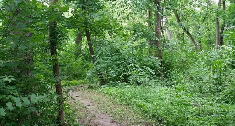
Smith's Island Nature Trail
check with the trail manager for updated details before visiting.
Smith's Island Nature Trail
U.S. Corps of Engineers
Backcountry Trail
- Length
1 mile
- Elevation Gain
--
- Route Type
out & back
- Length
1 mile - Elevation Gain
-- - Route Type
out & back
Smith's Island Nature Trail is a one-mile trail located near Pleasant Valley The trail is a naturalist's paradise, hosting oaks, woodland wildflowers, and Sugar Maple, as well as herons, osprey, and pelicans.
Location: Locks and Dam #14 Day Use Rec. Area
- States: Iowa
- Counties: Scott
- Cities/Townships: Pleasant Valley, Quad Cities
Smith's Island Nature Trail is a one-mile trail located near Pleasant Valley The trail is a naturalist's paradise, hosting oaks, woodland wildflowers, and Sugar Maple, as well as herons, osprey, and pelicans.
The trail is recognized for its unique wildlife and its value to the community as an educational and recreational entity. Although the Smith Island Trail is only one mile in length, it encompasses approximately 25 acres and is located along lock 14 in the Davenport/Le Claire area.
Because the trail provides winter refuge for a wide variety of wildlife including Geese, Herons, Osprey, Seagulls, and the American Bald Eagle, it attracts nature lovers and bird watchers from distant locations.
The trail and shore are maintained through the combined efforts of the Army Corps of Engineers, the Department of Natural Resources, and volunteer and private donations.
The Army Corps of Engineers also conducts various community-related events such as; fishing clinics, annual family clean-ups, and ECO-MEET, an educational program developed for younger-aged school children. The park currently functions as a Nature Preserve and Education Area.
Accessibility Information
No text provided.
Allowed Uses:
Boating, human-powered Dogs, on leash Hiking/Walking Snow, snowshoeingOther Activities
- Fishing
- Snow, snow play general
- Wildlife viewing / observation
Public Contact
US Army Corps of EngineersPleasant Valley, IA 52676
[email protected] • (309) 794-4524
www.mvr.usace.army.mil/Missions/Recreation/Mississippi-River-Projec
Contact the trail manager for current maps and visiting details.
More Details
- Elevation (low): 570
- Elevation (high): 582
- Elevation (cumulative): --
- Part of a Trail System? No
- Surface (primary): Wood chips/mulch
- Surfaces (additional): Soil
- Tread Width (average): 60"
- Tread Width (minimum): --
- Running length (minimum): --
- Tread Grade (average, percent): --
- Tread Grade (maximum): 3
- Running length (maximum): --
- Cross-slope (average, percent): --
- Cross-slope (maximum): --
- Running length (maximum): --
- Certified as an NRT
Jun 4, 2003


