Snake River Trail
This information is a public record of the 1981 NRT application and may be out of date if it has not been updated by a trail manager --
check with the trail manager for updated details before visiting.
check with the trail manager for updated details before visiting.
Snake River Trail
USDA Forest Service
Backcountry Trail
- Length
21 miles
- Elevation Gain
--
- Route Type
out & back
- Length
21 miles - Elevation Gain
-- - Route Type
out & back
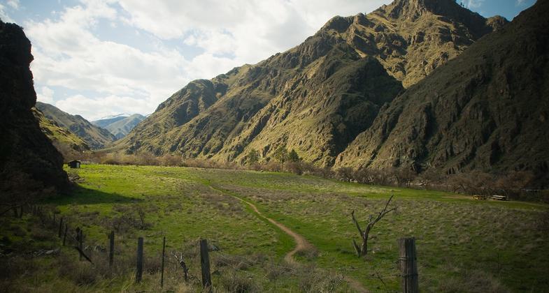
The Snake River National Recreation Trail (#102) winds its way along the Idaho side of the Wild and Scenic Snake River deep in the Hells Canyon National Recreation Area.
Location: Hells Canyon, In Wallowa-Whitman National Forest, connects Pittsburg Landing to Granite Creek along E bank of Snake River, both W of US 95.
- States: Idaho
- Counties: Idaho
The Snake River National Recreation Trail (#102) winds its way along the Idaho side of the Wild and Scenic Snake River deep in the Hells Canyon National Recreation Area. Beginning at the Snake River Trailhead near Pittsburg Landing, the trail goes across rocky slopes, under cliffs, and along grassy canyons eventually ending at Brush Creek.
Accessibility Information
No text provided.
Allowed Uses:
Equestrian Hiking/WalkingOther Activities
- Camping
Public Contact
Chris CookHells Canyon NRA
153 Hearthstone Dr.
Boise, ID 83549
(208) 794-7255
Contact the trail manager for current maps and visiting details.
More Details
- Elevation (low): --
- Elevation (high): --
- Elevation (cumulative): --
- Part of a Trail System? No
- Surface (primary): Soil
- Surfaces (additional): --
- Tread Width (average): 0"
- Tread Width (minimum): --
- Running length (minimum): --
- Tread Grade (average, percent): --
- Tread Grade (maximum):
- Running length (maximum): --
- Cross-slope (average, percent): --
- Cross-slope (maximum): --
- Running length (maximum): --
- Certified as an NRT
Jan 27, 1981


