Snohomish County Centennial Trail
check with the trail manager for updated details before visiting.
Snohomish County Centennial Trail
City, Town, or County
Rail Trail
- Length
7 miles
- Elevation Gain
--
- Route Type
out & back
- Length
7 miles - Elevation Gain
-- - Route Type
out & back
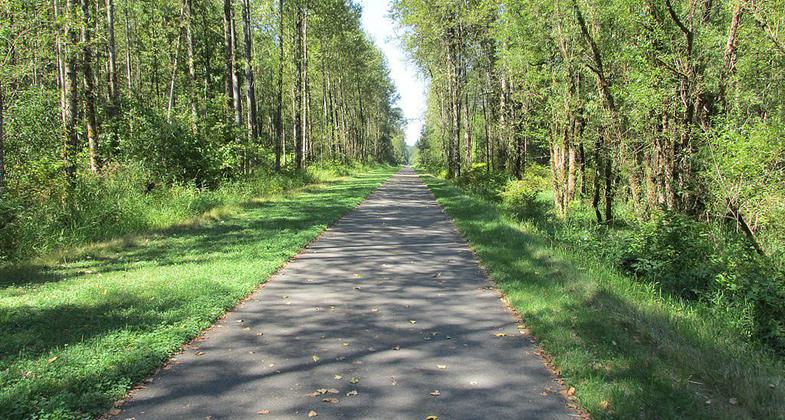
The trail is built on the old Burlington-Northern Railroad line.

Photo by Robert Ashworth.

Start of the Centennial Trail, Snohomish, Washington, following former Burlington Northern tracks. Abandoned tracks can be seen. Photo by Joe Mabel/wiki.

Photo by Robert Ashworth.
Location: Urban/Suburban/Rural
- States: Washington
- Counties: Snohomish
An enormously popular recreational trail for walking, bicycling, hiking, and horseback riding accessible to persons of all levels of physical ability.
The trail is built on the old Burlington-Northern Railroad line. Development of the trail began in 1989 during the state's centennial, hence the name, Centennial Trail.
The trailhead and rest stop in the town of Machias is a replica of the Machias Station railroad depot built in the late 1890s which served the rail line that today is the Centennial Trail. The Machias Trailhead facility is available for rent. Contact park reservations at 425-388-6600 for details.
More than 400,000 citizens utilize the trail each year as a recreational trail and non-motorized commuter corridor. This 30-mile linear park has become one of the most valued and well-used assets in our 10,800 acre system.
Accessibility Information
No text provided.
Allowed Uses:
Bicycling Dogs, on leash Equestrian Hiking/Walking Snow, cross-country skiingOther Activities
- Camping
- Snow, snow play general
- Wildlife viewing / observation
Public Contact
Marc KrandelSnohomish County Parks and Recreation
M/S #303, 3000 Rockefeller Ave.
Everett, WA 98201
[email protected] • (425) 388-6621
Contact the trail manager for current maps and visiting details.
More Details
- Elevation (low): --
- Elevation (high): --
- Elevation (cumulative): --
- Part of a Trail System? No
- Surface (primary): Paved
- Surfaces (additional): --
- Tread Width (average): 120"
- Tread Width (minimum): --
- Running length (minimum): --
- Tread Grade (average, percent): --
- Tread Grade (maximum):
- Running length (maximum): --
- Cross-slope (average, percent): --
- Cross-slope (maximum): --
- Running length (maximum): --
- Certified as an NRT
Sep 19, 1992

