South Creek Greenway
check with the trail manager for updated details before visiting.
South Creek Greenway
Nonprofit
Frontcountry Trail
Urban Trail
- Length
8 miles
- Elevation Gain
--
- Route Type
out & back
- Length
8 miles - Elevation Gain
-- - Route Type
out & back
South Creek Greenway is a wonderful eight-mile paved linear park running right through the middle of Springfield, Missouri. The trail offers numerous benefits including opportunities for bicycling, walking, running, skating, alternative transportation, environmental preservation, and economic stimulus.

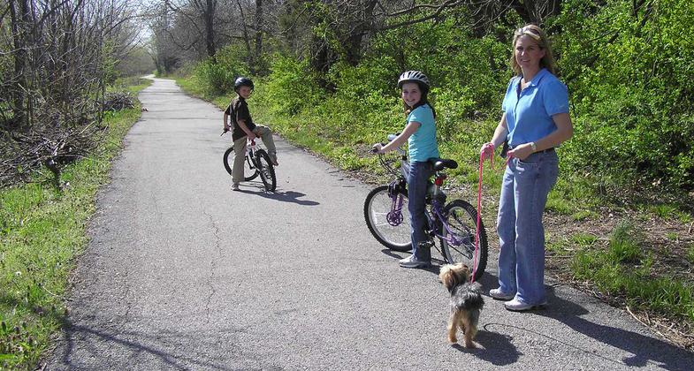
Biking to school. Photo by Terry Whaley.

Wild Coreopsis. Photo by Terry Whaley.

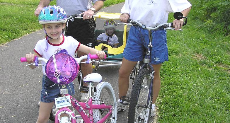
The Scott Family out biking. Photo by Terry Whaley.

Rumber Bridge on South Creek. Photo by Terry Whaley.

Photo by Terry Whaley.

Location: Urban trail that follows South Creek east/west through the middle of Springfield, MO, and then southwesterly between Sunshine Street and Battlefield Road along South Creek.
- States: Missouri
- Counties: Greene
- Cities/Townships: Springfield
South Creek Greenway is a wonderful eight-mile paved linear park running right through the middle of Springfield, Missouri. The trail offers numerous benefits including opportunities for bicycling, walking, running, skating, alternative transportation, environmental preservation, and economic stimulus.
South Creek Greenway (SC) is the quintessential urban trail, set in a natural landscape that's been carefully preserved within a heavily developed city. Whether used for biking, walking, running, enjoying nature close to home, or commuting without a car to work or school, this paved trail pays enormous benefits for the residents and visitors of the Springfield, Missouri, community.
We have a great partnership with the Springfield-Greene County Park Board, as they manage the trail as part of the county park system. We've also been very successful working with Springfield Public Works to partner on enlarging stormwater culverts to allow for more water while also improving trail user safety by bypassing heavily trafficked roads by removing at-grade crossings. SC has four underpasses and one large overpass as a result of these types of partnerships, not to mention the project money saved for both parties by teaming up! Other partners on this project include MoDOT, the Missouri Department of Natural Resources, Springfield Public School District, and the Springfield Convention & Visitors Bureau. A long-term goal for this trail is to link to the NPS's Wilson's Creek National Battlefield.
SC links to other community trails through an on-street bike route system being developed by our Public Works Department. Some of the best features of this trail are the four underpasses and the large Kansas Expressway overpass that allow bicyclists and pedestrians to avoid crossing very heavily trafficked roads. Three schools are located along its route and signed for the national Safe Routes to School program initiative (Holland Elementary, Carver Middle, Mark Twain Elementary).
Accessibility Information
No text provided.
Allowed Uses:
Bicycling Dogs, on leash Hiking/WalkingOther Activities
- Wildlife viewing / observation
Public Contact
Miles ParkSpringfield-Greene County Park Board
1923 N. Weller
Springfield, MO 65802
(417) 864-1335
www.parkboard.org
Contact the trail manager for current maps and visiting details.
More Details
- Elevation (low): --
- Elevation (high): --
- Elevation (cumulative): --
- Part of a Trail System? No
- Surface (primary): Paved
- Surfaces (additional): Paved, Wood chips/mulch
- Tread Width (average): 120"
- Tread Width (minimum): --
- Running length (minimum): --
- Tread Grade (average, percent): --
- Tread Grade (maximum): 3
- Running length (maximum): --
- Cross-slope (average, percent): --
- Cross-slope (maximum): --
- Running length (maximum): --
- Certified as an NRT
May 2, 2010


