South Rim
This information is a public record of the 1981 NRT application and may be out of date if it has not been updated by a trail manager --
check with the trail manager for updated details before visiting.
check with the trail manager for updated details before visiting.
South Rim
National Park Service
Backcountry Trail
- Length
9 miles
- Elevation Gain
--
- Route Type
out & back
- Length
9 miles - Elevation Gain
-- - Route Type
out & back

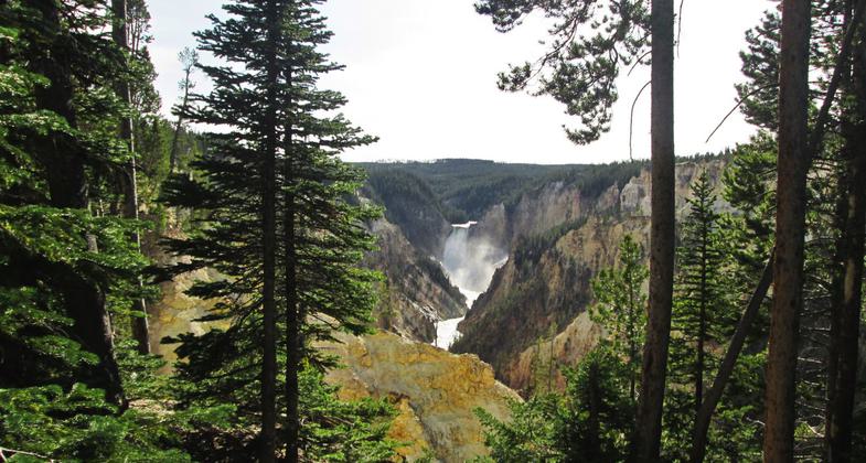
View from the South Rim Trail, near Artist's Point, Yellowstone National Park. Photo by Valerie A. Russo.

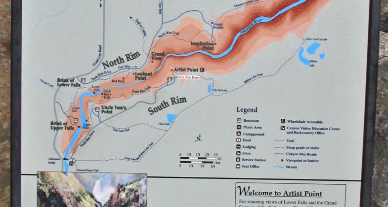
Close-up of sign, Artist's Point, Yellowstone National Park. Photo by Valerie A. Russo.

You are here - Artist's Point, on the South Rim Trail, Yellowstone National park. Photo by Valerie A. Russo.
Location: In Yellowstone National Park along S rim of Yellowstone Canyon from the Falls.
- States: Wyoming
- Counties: Park
Yellowstone's Lower Falls is 308 ft. high and can be seen from various points on the South Rim Trail. The Lower Falls is often described as being more than twice the size of Niagara, although this only refers to its height and not the volume of water flowing over it. The volume of water flowing over the falls can vary from 63,500 gal/sec at peak runoff to 5,000 gal/sec in the fall.
Accessibility Information
No text provided.
Allowed Uses:
Hiking/WalkingPublic Contact
DaveYellowstone National Park
P.O. Box 168
Yellowstone National Park, WY 82190
(307) 344-2319
Contact the trail manager for current maps and visiting details.
More Details
- Elevation (low): --
- Elevation (high): --
- Elevation (cumulative): --
- Part of a Trail System? No
- Surface (primary): --
- Surfaces (additional): --
- Tread Width (average): 0"
- Tread Width (minimum): --
- Running length (minimum): --
- Tread Grade (average, percent): --
- Tread Grade (maximum):
- Running length (maximum): --
- Cross-slope (average, percent): --
- Cross-slope (maximum): --
- Running length (maximum): --
- Certified as an NRT
Mar 19, 1981


