South Yuba Trail
This information is a public record of the 1971 NRT application and may be out of date if it has not been updated by a trail manager --
check with the trail manager for updated details before visiting.
check with the trail manager for updated details before visiting.
South Yuba Trail
Bureau of Land Management
Backcountry Trail
- Length
12 miles
- Elevation Gain
--
- Route Type
out & back
- Length
12 miles - Elevation Gain
-- - Route Type
out & back
The South Yuba Trail takes hikers, mountain bikers, and horseback riders through historic foothill river canyons. Expect to see evidence of California's rich gold rush history.

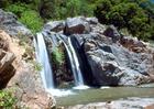
A waterfall on the South Fork Yuba River in South Yuba River State Park. Photo by USACE.
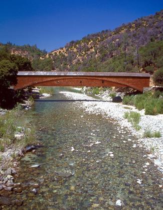
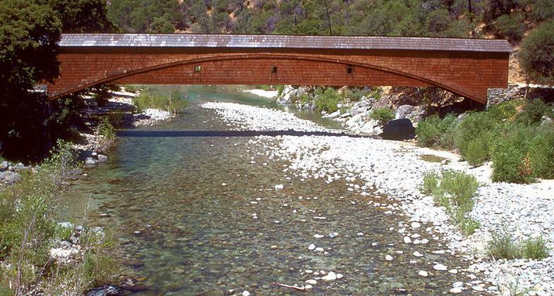
The Bridgeport Covered Bridge on the South Fork Yuba River in South Yuba River State Park. Photo by USACE.
Location: From Nevada City take SR 49 to N Bloomfield Rd., then 10 mi. to S Yuba Recreational Lands, 1.5 mi. on past Edwards Crossing.
- States: California
- Counties: Sacramento
This 15-mile trail is open to hiking, horseback riding, trail running, and mountain biking. The trail is closed to motorized vehicles. Through pine-covered canyons to open meadows/hillsides, past historic flumes, and waterworks. Swimming holes and rainbow trout pools.
Accessibility Information
No text provided.
Allowed Uses:
Swimming Dogs, on leashOther Activities
- Camping
- Fishing
Public Contact
Jeff HornBureau of Land Management
Folsom Field Office
Folsom, CA 95630
(916) 985-4474
Contact the trail manager for current maps and visiting details.
More Details
- Elevation (low): --
- Elevation (high): --
- Elevation (cumulative): --
- Part of a Trail System? No
- Surface (primary): --
- Surfaces (additional): --
- Tread Width (average): 0"
- Tread Width (minimum): --
- Running length (minimum): --
- Tread Grade (average, percent): --
- Tread Grade (maximum):
- Running length (maximum): --
- Cross-slope (average, percent): --
- Cross-slope (maximum): --
- Running length (maximum): --
- Certified as an NRT
Jun 1, 1971