Springhill Mountain Bike Trail
check with the trail manager for updated details before visiting.
Springhill Mountain Bike Trail
U.S. Corps of Engineers
Backcountry Trail
- Length
10 miles
- Elevation Gain
--
- Route Type
Loop
- Length
10 miles - Elevation Gain
-- - Route Type
Loop
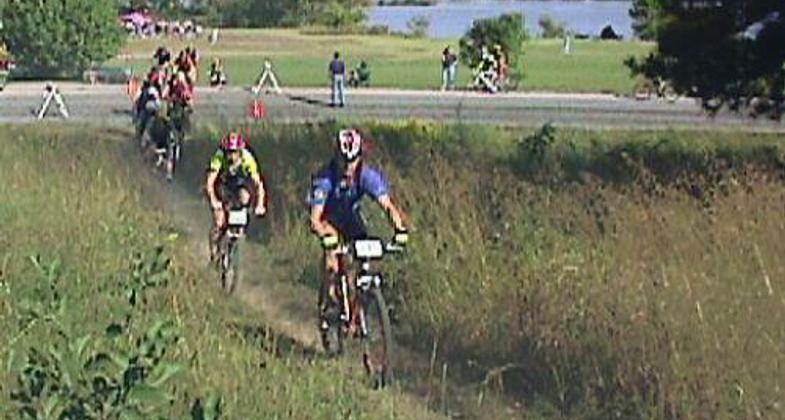
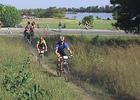
The U.S. Army Corps of Engineers partners with Mercy Cycling to manage the 10 mile long Springhill Park Mountain Bike Trail. The winding trail consists of 3 loops. The trail was constructed in August of 2001.

Location: Springhill Mountain Bike Trail is within Springhill Park in Barling, Arkansas.
- States: Arkansas
- Counties: Sebastian
In 2001, the Corps of Engineers partnered with Mercy Cycling Club (Mercy Cycling) to construct a mountain bike trail in Springhill Park. The purpose of the trail was two-fold. Undesirable activity discouraged park users from the Corps park and Mercy Cycling Club was seeking a location to build a permanent trail. An environment conducive for families, hikers, and bikers was created upon completion of the trail. The use of the trail by citizens reduced undesirable activities in the park. Additionally, a lasting trail and home were realized by Mercy Cycling.
The trail's 10-mile route twists and winds like a spider web. Low-impact bridges, built to the standards of the International Mountain Bike Association (IMBA), cross gullies that empty into the Arkansas River. A Boy Scout identified a safety issue on the trail. He constructed a concave, brick, and earthen structure for riders to shoot around a 90-degree turn. The scout received credit for a service project toward certification as an Eagle Scout. Citizens of Sebastian and Crawford counties benefit from the safe and healthy environment. The park's location on the eastern flank of Barling, Arkansas provides an escape from the close-quarter housing and traffic in the Fort Smith/Van Buren metropolitan area.
Regionally known as a fast trail by experienced mountain bikers from Arkansas, Oklahoma, Missouri, and Texas the riders take part in two annual competitions sanctioned by IMBA. Mercy Cycling conducts races for area riders on a monthly basis. Parents teach bicycle riding skills and trail etiquette to their children. Volunteers spend at least 2 days a month conducting maintenance on the trail. Volunteers identify and repair erosion sites reroute portions of the trail impacted by continuous use and also build and maintain bridges. St. Edwards Mercy Medical Center donates material to maintain the bridges. The Corps of Engineers supplies aggregate material to maintain the trail.
The trail is within the City of Barling, Arkansas. Barling Police Department and Corps of Engineers Park Rangers patrol the park. A long-lasting relationship has resulted between the U.S. Army Corps of Engineers, Mercy Cycling, and St. Edwards Mercy Medical Center. The surrounding area, the Arkansas River Valley, offers many federal, state, and city parks that will meet the needs of any visitor. Springhill Park lies just outside of Barling and is a close drive into Van Buren and Fort Smith for lodging, restaurants, and shopping.
Rules of the Trail:
1. Control your bicycle. This is particularly important when you meet others on the trail. Good balance and proper braking are essential mountain biking skills.
2. Leave no trace. Don't ride in conditions where you will leave evidence of your passing, especially on certain soils after rain. Stay on existing trails and don't create new ones. Leave what you find and pack out your trash.
3. Always yield the trail. The steps are simple; slow down, establish communication with the people you meet, and pass safely. Yielding
doesn't always mean stopping and dismounting, though sometimes that's the best idea.
4. Never spook animals. It doesn't matter if it's a fox, bear, or deer. Give all animals plenty of room and try not to startle them.
5. Plan ahead. Carry everything you need for a good ride: a spare tube and a pump, a rain jacket, and basic tools. Know where you're riding. Wear a helmet.
Accessibility Information
No text provided.
Allowed Uses:
Bicycling Dogs, on leash Hiking/WalkingPublic Contact
Scott FryerU.S. Army Corps of Engineers
1598 Lock and Dam Road
Russellville, AR 72802
[email protected] • (479) 968-5008
Contact the trail manager for current maps and visiting details.
More Details
- Elevation (low): 372
- Elevation (high): 450
- Elevation (cumulative): --
- Part of a Trail System? No
- Surface (primary): Soil
- Surfaces (additional): Grass or Vegetation, Rock, boulders, Rock, smooth, Soil, Soil with stabilizer
- Tread Width (average): 12"
- Tread Width (minimum): --
- Running length (minimum): --
- Tread Grade (average, percent): 2
- Tread Grade (maximum): 20
- Running length (maximum): --
- Cross-slope (average, percent): --
- Cross-slope (maximum): --
- Running length (maximum): --
- Certified as an NRT
May 19, 2011