Spyglass Hill Trail
check with the trail manager for updated details before visiting.
Spyglass Hill Trail
U.S. Corps of Engineers
Backcountry Trail
- Length
22 miles
- Elevation Gain
--
- Route Type
Loop
(1 review)
- Length
22 miles - Elevation Gain
-- - Route Type
Loop
Spyglass Hill Trail is a 22-mile multi-purpose trail that winds along the US Army Corps of Engineers Enid Lake shoreline. Spyglass Hill Trail is moderately hilly terrain with rock outcrops and scenic views of Enid Lake. The trail runs through Ford's Well Campground, which is the center point of Spyglass Hill Trail. Fords Well Campground offers 18 class-A campsites with historic amenities.
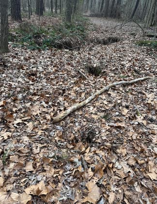
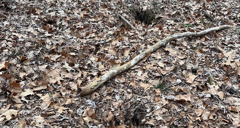
Leaf-covered Holes on a southern loop
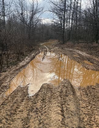
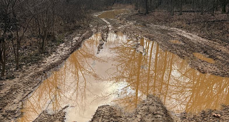
An example of the extensive damage caused by by ATVs
Location: Enid Lake US Army Corps of Engineers Mississippi
- States: Mississippi
- Counties: Yalobusha
- Cities/Townships: S13 T11S R6W
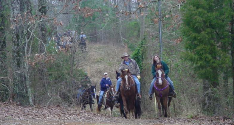
Spyglass Hill Trail is a 22-mile multi-purpose use trail located along the south side of Enid Lake between Point Pleasant Recreation Area and Spyglass Hill. The trail offers visitors opportunities to ride horses, walk, hike, and jog. In addition to recreational opportunities, the trail is used for educational and interpretive programs. One of the main features of the Spyglass Hill Trail is Ford's Well. Ford's Well is a point of historical significance for many local citizens who recall friends and family members who were attracted to the area in the early 1900s to either drink or bathe in the therapeutic well water.
Visitors will step back in time when they arrive to find hand-hewn timber buildings, including a barn/crib, outhouse, blacksmith shop, and cabin. These buildings depict the type of environment that would have been present at Ford's Well during its heyday around the turn of the century. In addition to the trail and turn-of-the-century buildings, visitors will find a Class A wrangler campground with 18 campsites with amenities that cater to the equestrian camper. Spyglass Hill Trail also offers outdoor enthusiasts numerous locations for viewing plant and tree species as well as wildlife species that are natural to the area. Nature photographers will find Spyglass Hill Trail a perfect location for capturing a late summer sunset or a rock sculpture made from some of the largest sandstone outcrops in the area. Amenities to the trail include parking areas, a picnic shelter, a gazebo, hitching rails, picnic tables, rest stops, and a shower house. Spyglass Hill Trail has been recognized and is part of the National Recreational Trail System.
Accessibility Information
No text provided.
Reviews
Patricia Ellis
ATVs have wrecked this trail
This trail is completely chewed up by ATVs. The deep ruts in soft ground have destroyed large sections of the trail, making the experience a slog through deep and muddy pits and shoe-sucking deep muck. It was so bad I had to bail. Tried multiple entry points only to find the same ATV issues. The only part I could manage was one southern loop, which thankfully has been spared from ATV use, but even that loop had problems. One tiny part was decent, but another had a faded sign saying “HOLES” to warn you about the sinkholes hidden by fallen leaves. Hiking that was similar to trying to avoid snow-covered frozen postholes during winter mountain treks. That loop also doesn’t match with the campground-provided map or my Gaia app. Managed less than 5 miles of the intended 22. The campground at the Recreation Area looks quite nice, anyway. Hiked/attempted Feb 6, 2025.
Allowed Uses:
Bicycling Dogs, on leash EquestrianPublic Contact
Michael RobinsonEnid Lake US Army Corps of Engineers
PO Box 10 Enid Lake Field Office
Enid, MS 38927
[email protected] • 662 563 4571
Contact the trail manager for current maps and visiting details.
More Details
- Elevation (low): 250
- Elevation (high): 350
- Elevation (cumulative): --
- Part of a Trail System? No
- Surface (primary): Soil
- Surfaces (additional): Grass or Vegetation, Soil
- Tread Width (average): 120"
- Tread Width (minimum): 120
- Running length (minimum): --
- Tread Grade (average, percent): 15
- Tread Grade (maximum): 30
- Running length (maximum): --
- Cross-slope (average, percent): 10
- Cross-slope (maximum): --
- Running length (maximum): --
- Certified as an NRT
Oct 23, 2020

