St. Paul Island High Bluffs Trail
check with the trail manager for updated details before visiting.
St. Paul Island High Bluffs Trail
- Length
6 miles - Elevation Gain
-- - Route Type
out & back
Location: St. Paul Island, Pribilof Archipelago, Bering Sea
- States: Alaska
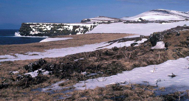
St. Paul Island is located more than 300 miles from mainland Alaska in the heart of the Bering Sea. The community of St. Paul has 650 residents of mostly Native Aleut ancestry and receives hundreds of visitors each year. The terrain of St. Paul Island is rugged and roads and trails are important for outdoor recreation opportunities. The High Bluffs Trail is a great way for visitors and residents of St. Paul Island to access and enjoy public lands administered as part of the Alaska Maritime National Wildlife Refuge. A kiosk at the Southwest Point trailhead and parking area displays interpretive panels which orient visitors as they begin their trip through a landscape dominated by coastal cliffs, rolling tundra, windswept beaches, and the boundless Bering Sea. Recently installed gates and signs at the north and south trailheads were funded through partnerships between the USFWS, St. Paul Tribal Government, Pribilof Island Stewardship Program, and the City of St. Paul. These gates manage vehicle access to the trail to protect sensitive habitats while still providing access to activities such as hiking, wildlife observation and photography, hunting, and traditional recreation activities. Continued improvements will ensure that this increasingly popular trail will be available to all for generations to come.
Accessibility Information
No text provided.
Allowed Uses:
Bicycling Hiking/Walking Motorized vehicles, – ATV/ORV Motorized vehicles, – four-wheel drive Snow, snowshoeingOther Activities
- Snow, snow play general
- Wildlife viewing / observation
Public Contact
Kent SundsethAlaska Maritime NWR
95 Sterling Highway, Ste 1
Homer, AK 99603
kent_sundseth@fws.gov • (907) 235-6546
Contact the trail manager for current maps and visiting details.
More Details
- Elevation (low): 5
- Elevation (high): 400
- Elevation (cumulative): --
- Part of a Trail System? No
- Surface (primary): Grass or Vegetation
- Surfaces (additional): Grass or Vegetation
- Tread Width (average): 96"
- Tread Width (minimum): --
- Running length (minimum): --
- Tread Grade (average, percent): 5
- Tread Grade (maximum): 15
- Running length (maximum): --
- Cross-slope (average, percent): --
- Cross-slope (maximum): --
- Running length (maximum): --
- Certified as an NRT
May 31, 2006


