State Line Trail
This information is a public record of the 1980 NRT application and may be out of date if it has not been updated by a trail manager --
check with the trail manager for updated details before visiting.
check with the trail manager for updated details before visiting.
State Line Trail
USDA Forest Service
Backcountry Trail
- Length
18.3 miles
- Elevation Gain
--
- Route Type
out & back
- Length
18.3 miles - Elevation Gain
-- - Route Type
out & back
Location: Between Lolo and St. Joe NFs, SW of Superior.
- States: Montana
- Counties: Mineral
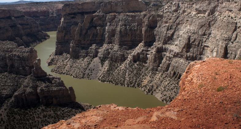
For a serene private view of Bighorn Canyon, follow the trail markers from the trailhead sign just north of the Montana state line. The trail leads to the rim through juniper shrubland above limestone plateaus to discover a breathtaking view.
You can easily follow the trail markers along the ridge for several hundred feet, enjoying different views of the river-carved canyon with every step. Just as the markers start directing you back to your vehicle, a small lizard disappears under sagebrush reminding you to take one last look.
Accessibility Information
No text provided.
Allowed Uses:
Hiking/WalkingPublic Contact
Lolo National ForestBuilding 24
Missoula, MT 59801
Contact the trail manager for current maps and visiting details.
More Details
- Elevation (low): --
- Elevation (high): --
- Elevation (cumulative): --
- Part of a Trail System? No
- Surface (primary): --
- Surfaces (additional): --
- Tread Width (average): 0"
- Tread Width (minimum): --
- Running length (minimum): --
- Tread Grade (average, percent): --
- Tread Grade (maximum):
- Running length (maximum): --
- Cross-slope (average, percent): --
- Cross-slope (maximum): --
- Running length (maximum): --
- Certified as an NRT
Oct 23, 1980


