Stony Lonesome OHV Park Trail System
check with the trail manager for updated details before visiting.
Stony Lonesome OHV Park Trail System
City, Town, or County
Backcountry Trail
- Length
150 miles
- Elevation Gain
--
- Route Type
Loop
- Length
150 miles - Elevation Gain
-- - Route Type
Loop
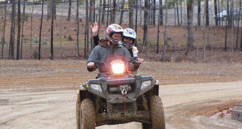
150 miles of trails for hiking, mountain bikes, dirt bikes, ATVs, Rock Crawlers, and horseback riding. The 1500-acre park's topography includes rolling hills, steep inclines, wetlands, and flowing streams.

Photo by Rob Grant.

Photo by John W. Sellers.

Equestrians on trail. Photo by John W. Sellers.

Photo by John W. Sellers.

Photo by John W. Sellers.

Stony Lonesome OHV Park National Recreation Trail. Photo by Rob Grant.

Location: near Bremen in Cullman County, Alabama, At 8323 State Route 69 south near Bremen.
- States: Alabama
- Counties: Cullman
The Stony Lonesome OHV Park is a 1500-acre Cullman County-owned and managed Public Park that opened in March 2009 near Bremen in Cullman, Alabama. The OHV Park is totally dedicated to being a family-oriented safe, environmentally friendly park dedicated to serving the local and regional needs of North Alabama and the Southeast. The OHV Park is open Tuesday through Sunday from 8:00 am-5:00 pm daily and offers over 150 miles of trails for hiking, mountain bikes, dirt bikes, ATVs, Four- Wheelers, Rock Crawlers, and horseback riding. The trail system has attracted tremendous interest and support from trail enthusiasts. It is the culmination of efforts by the County and community leaders in planning, land acquisition, and trail development.
Accessibility Information
No text provided.
Allowed Uses:
Bicycling Dogs, on leash Equestrian Hiking/Walking Motorized vehicles, – ATV/ORV Motorized vehicles, – four-wheel drive Motorized vehicles, motorcyclingOther Activities
- Camping
- Wildlife viewing / observation
Public Contact
Mary PadenStony Lonesome OHV Park
10075 AL Hwy 69 South
Bremen, AL 35033
[email protected] • (256) 287-1133
www.stonylonesomeohv.u
Contact the trail manager for current maps and visiting details.
More Details
- Elevation (low): --
- Elevation (high): --
- Elevation (cumulative): --
- Part of a Trail System? No
- Surface (primary): Soil
- Surfaces (additional): Grass or Vegetation, Rock, boulders, Rock, crushed, Rock, smooth, Soil, Water, slow moving, Water, calm
- Tread Width (average): 84"
- Tread Width (minimum): --
- Running length (minimum): --
- Tread Grade (average, percent): --
- Tread Grade (maximum): 80
- Running length (maximum): --
- Cross-slope (average, percent): --
- Cross-slope (maximum): --
- Running length (maximum): --
- Certified as an NRT
May 2, 2010

