Sugar Loaf Mountain Nature Trail
check with the trail manager for updated details before visiting.
Sugar Loaf Mountain Nature Trail
U.S. Corps of Engineers
Backcountry Trail
- Length
2.1 miles
- Elevation Gain
--
- Route Type
Loop
- Length
2.1 miles - Elevation Gain
-- - Route Type
Loop
Sugar Loaf Mountain Island rises 540 feet above Greers Ferry Lake, 1002 feet above sea level at the highest point. The trail is 1.6 miles and hosts a year-round adventure of flora, fauna, and geological formations. An intermediate trail guarded by towering bluffs and intricate rock formations circles the sandstone mountain providing a less strenuous pace for nature enthusiasts.

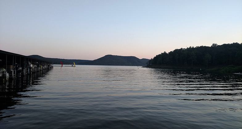
Fairfield Bay Marina at sundown. Photo by Brandonrush.

View of Sugarloaf Mountain from Greers Ferry Lake. Photo by Brandonrush.
Location: Near Heber Springs at Greers Ferry Lake.
- States: Arkansas
- Counties: Van Buren
Sugar Loaf Mountain Island rises 540 feet above Greers Ferry Lake, 1002 feet above sea level at the highest point. The trail is 1.6 miles and hosts a year-round adventure of flora, fauna, and geological formations. An intermediate trail guarded by towering bluffs and intricate rock formations circles the sandstone mountain providing a less strenuous pace for nature enthusiasts. The trail segment to the top is made by flights of wooden steps that were hand fitted between vertical fractures relentlessly sculpted y erosion. The island top provides an unequaled panoramic view of the surrounding lake and Ozark Mountains. Sugar Loaf Mountain is only accessible by boat and restroom facilities are not available. You should allow a minimum of 2 hours for the trip.
Accessibility Information
No text provided.
Allowed Uses:
Swimming Dogs, on leash Hiking/WalkingPublic Contact
Jeff PriceUS Army Corps of Engineers
P.O. Box 1088
Heber Springs, AR 72543
[email protected] • (501) 362-2416
Contact the trail manager for current maps and visiting details.
More Details
- Elevation (low): 461
- Elevation (high): 1000
- Elevation (cumulative): --
- Part of a Trail System? No
- Surface (primary): Soil
- Surfaces (additional): Grass or Vegetation, Rock, boulders
- Tread Width (average): 30"
- Tread Width (minimum): --
- Running length (minimum): --
- Tread Grade (average, percent): --
- Tread Grade (maximum):
- Running length (maximum): --
- Cross-slope (average, percent): --
- Cross-slope (maximum): --
- Running length (maximum): --
- Certified as an NRT
Jun 1, 1971


