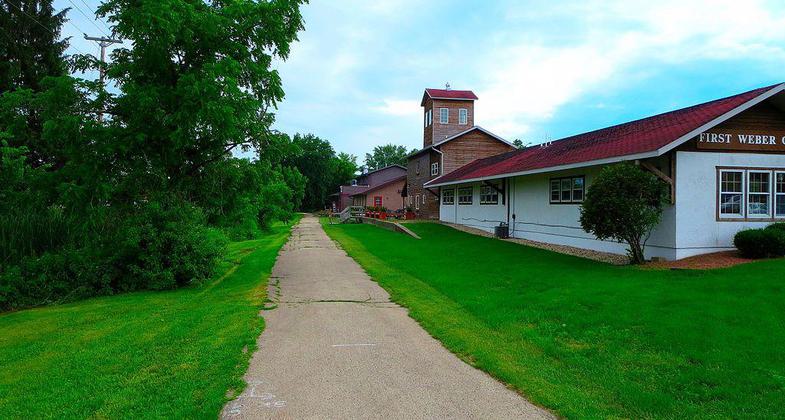
Sugar River State Trail
This information is a public record of the 1974 NRT application and may be out of date if it has not been updated by a trail manager --
check with the trail manager for updated details before visiting.
check with the trail manager for updated details before visiting.
Sugar River State Trail
State
Rail Trail
- Length
23 miles
- Elevation Gain
--
- Route Type
out & back
(1 review)
- Length
23 miles - Elevation Gain
-- - Route Type
out & back
The Sugar River State Trail follows an abandoned railroad line in south central Wisconsin for 24 miles from New Glarus to Brodhead.
Location: 20 miles W of Janesville, joins Brodhead to New Glarus.
- States: Wisconsin
Follows the abandoned Chicago, Milwaukee, St Paul railroad bed. Trestle bridges over streams, through rolling hills, verdant meadows and state wildlife areas
Accessibility Information
No text provided.
Reviews
Mary Getlinger
Sugar River Trail needs maintenance in places
We rode the trail from New Glarus to Brodhead about 2 weeks ago. There are some dangerous potholes and many places that should be regraded and resurfaced. It is a beautiful trail but it needs attention.
Allowed Uses:
Bicycling Dogs, on leash Hiking/Walking Motorized vehicles, snowmobiling Snow, cross-country skiing Snow, snowshoeingOther Activities
- Fishing
- Snow, snow play general
- Wildlife viewing / observation
Public Contact
Melissa BurnsWisconsin Dept. of Natural Resources
5446 City Hwy NN
New Glarus, WI 53574
[email protected] • (608) 527-2335
dnr.wi.gov/topic/parks/name/sugarriver
Contact the trail manager for current maps and visiting details.
More Details
- Elevation (low): --
- Elevation (high): --
- Elevation (cumulative): --
- Part of a Trail System? No
- Surface (primary): --
- Surfaces (additional): --
- Tread Width (average): 120"
- Tread Width (minimum): --
- Running length (minimum): --
- Tread Grade (average, percent): --
- Tread Grade (maximum):
- Running length (maximum): --
- Cross-slope (average, percent): --
- Cross-slope (maximum): --
- Running length (maximum): --
- Certified as an NRT
Sep 17, 1974


