Sugarloaf Trail
This information is a public record of the 1979 NRT application and may be out of date if it has not been updated by a trail manager --
check with the trail manager for updated details before visiting.
check with the trail manager for updated details before visiting.
Sugarloaf Trail
USDA Forest Service
Urban Trail
- Length
5 miles
- Elevation Gain
--
- Route Type
out & back
- Length
5 miles - Elevation Gain
-- - Route Type
out & back
Location: Rural, In San Bernardino National Forest at Green Canyon Creek south of Big Bear City.
- States: California
- Counties: San Bernardino
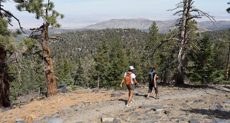
Sugarloaf National Recreation Trail is a difficult 10-mile trek to the highest point in Big Bear Valley. The first 2 miles of the trail is a dirt road, at times following Green Creek. Although the view from the summit of Sugarloaf Mountain is mostly obscured by trees you have climbed to an altitude of 9,952 feet.
Accessibility Information
No text provided.
Allowed Uses:
Bicycling Dogs, on leash Equestrian Hiking/Walking Snow, cross-country skiing Snow, snowshoeingOther Activities
- Camping
- Snow, snow play general
Public Contact
Big Bear Discovery CenterP.O. Box 290
Fawnskin, CA 92333
(909) 382-2790
Contact the trail manager for current maps and visiting details.
More Details
- Elevation (low): --
- Elevation (high): --
- Elevation (cumulative): --
- Part of a Trail System? No
- Surface (primary): --
- Surfaces (additional): --
- Tread Width (average): 36"
- Tread Width (minimum): --
- Running length (minimum): --
- Tread Grade (average, percent): --
- Tread Grade (maximum):
- Running length (maximum): --
- Cross-slope (average, percent): --
- Cross-slope (maximum): --
- Running length (maximum): --
- Certified as an NRT
Aug 16, 1979


