Summit Trail
This information is a public record of the 1979 NRT application and may be out of date if it has not been updated by a trail manager --
check with the trail manager for updated details before visiting.
check with the trail manager for updated details before visiting.
Summit Trail
USDA Forest Service
Backcountry Trail
- Length
12 miles
- Elevation Gain
--
- Route Type
out & back
- Length
12 miles - Elevation Gain
-- - Route Type
out & back

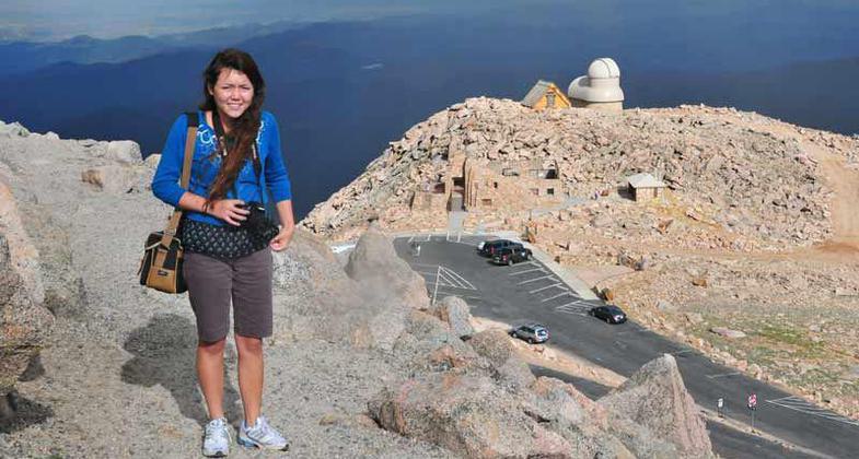
Young photographer on the Mt. Evans NRT summit trail, with the parking area below; Photo by Kim Schmidt.
Location: From Springville 30 mi. E on SR 190. Trail crosses hwy near Co. Rd 107 and FS Rd. 21550 near Quaking Aspen Campground.
- States: California
- Counties: Tulare
The trail climbs and crosses the summit of Slate Mountain on its way to the log cabin meadow at Clicks Creek. From the summit of Slate Mountain, visitors have a view of the southern San Joaquin Valley to the west, the Kern Plateau to the east, and the Golden Trout Wilderness Area to the northeast. A portion of the trail forms the southeast edge of the Slate Mountain Botanical Area. The entire NRT is located within the Giant Sequoia National Monument.
Accessibility Information
No text provided.
Allowed Uses:
Hiking/WalkingPublic Contact
Denise AlonzoUS Forest Service
Tule River & Hot Springs Ranger District
Springville, CA 93265
(559) 539-2607 ext. 55
Contact the trail manager for current maps and visiting details.
More Details
- Elevation (low): 6994
- Elevation (high): 9014
- Elevation (cumulative): --
- Part of a Trail System? No
- Surface (primary): Rock, boulders
- Surfaces (additional): Soil
- Tread Width (average): 48"
- Tread Width (minimum): --
- Running length (minimum): --
- Tread Grade (average, percent): 13
- Tread Grade (maximum): 18
- Running length (maximum): --
- Cross-slope (average, percent): --
- Cross-slope (maximum): --
- Running length (maximum): --
- Certified as an NRT
Oct 4, 1979

