Sunset Drive Trail
check with the trail manager for updated details before visiting.
Sunset Drive Trail
City, Town, or County
Backcountry Trail
Frontcountry Trail
- Length
3.66 miles
- Elevation Gain
--
- Route Type
out & back
- Length
3.66 miles - Elevation Gain
-- - Route Type
out & back
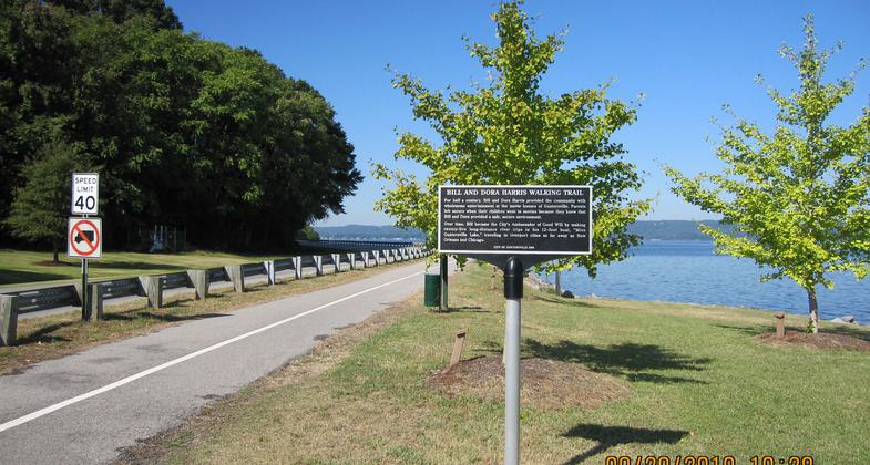
The Guntersville Sunset Drive Trail combines old southern charm and spectacular views of Lake Guntersville on the Tennessee River.
Location: West side of City of Guntersville along the shore of Lake Guntersville on the Tennessee River
- States: Alabama
- Counties: Marshall
The paved recreational trail runs along the town's well-preserved historic homes and ends with spectacular views of beautiful Lake Guntersville on the Tennessee River. The Sunset Drive Trail's total distance is 3.66 miles with a round trip distance of 7.32 miles.
The Tennessee Valley Authority began construction of Guntersville Dam on December 4, 1935, and completed it on January 24, 1939. As the reservoir filled with water, it surrounded Guntersville, leaving the city sitting on a peninsula. The City of Guntersville has enhanced the shoreline with public walking and biking trails. The city's recreational facilities along the lake include a fishing pier, band shelter, recreation center, swimming pool, senior center, many outdoor sports facilities, and playground and picnic areas, totaling 175 acres of public parkland.
The horticulture department, located at the recreation center, was established in 2001 by the City of Guntersville under the supervision of Wendy Walker. This department is responsible for landscape designs along the trail. The Guntersville Tree Commission works in close contact with the horticulturist and staff on various projects, including the Sunset Drive Trail; Project Knowledge, which is the tree project along the walking trail on Sunset Drive; and The Memorial Tree Project which places a tree in honor or in memory of someone on city property, many of which can be seen along the Sunset Drive Trail. The Sunset Drive Trail combines fun, nature, and exercise within view of the vast Lake Guntersville on the Tennessee River!
Accessibility Information
No text provided.
Allowed Uses:
Swimming Dogs, on leash Hiking/WalkingOther Activities
- Wildlife viewing / observation
Public Contact
Mr. Ken ArdGuntersville Parks and Recreation Department
1500 Sunset Drive
Guntersville, AL 33597
[email protected] • (256) 571-7590
www.guntersvilleal.org/city_services/REC_parks_recreation.
Contact the trail manager for current maps and visiting details.
More Details
- Elevation (low): 597
- Elevation (high): 620
- Elevation (cumulative): --
- Part of a Trail System? No
- Surface (primary): Paved
- Surfaces (additional): Paved
- Tread Width (average): 60"
- Tread Width (minimum): --
- Running length (minimum): --
- Tread Grade (average, percent): 1
- Tread Grade (maximum): 1
- Running length (maximum): --
- Cross-slope (average, percent): --
- Cross-slope (maximum): --
- Running length (maximum): --
- Certified as an NRT
May 19, 2011


