Swamp Park Trail
check with the trail manager for updated details before visiting.
Swamp Park Trail
USDA Forest Service
Backcountry Trail
- Length
18.3 miles
- Elevation Gain
--
- Route Type
out & back
- Length
18.3 miles - Elevation Gain
-- - Route Type
out & back
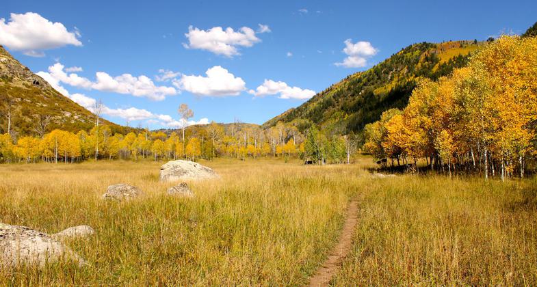
The Swamp Park Trail features beautiful landscapes along a creek and into Mount Zirkel Wilderness which covers almost half the trail's length.

Pedaling old school singletrack near Steamboat Springs. Photo by Singletracks.com/Greg Heil.
Location: Beginning: T7N, R85W; Ending: T9N, R84W, Section 11, In Routt National Forest, NW of Steamboat Springs on Co. Rd. 129. In Routt National Forest, NW of Steamboat Springs on Co. Rd. 129.
- States: Colorado
- Counties: Routt
Swamp Park National Recreation Trail is 20.6 miles long (one way), a backcountry-type trail that is frequented by hikers, equestrians, and bikers especially from April to September. It is moderately difficult but interestingly long and serene with light to moderate traffic. The trail traverses from the South Fork of the Elk River Road to Elk Park, crossing Elk River, Big Creek, and Mad Creek drainages along the way.
Accessibility Information
No text provided.
Allowed Uses:
Dogs, on leashPublic Contact
US Forest Service925 Weiss Drive
Steamboat Springs, CO 80487
[email protected] • (970) 879-1870
www.fs.fed.us/r2/mbr
Contact the trail manager for current maps and visiting details.
More Details
- Elevation (low): 6760
- Elevation (high): 9600
- Elevation (cumulative): --
- Part of a Trail System? No
- Surface (primary): Soil
- Surfaces (additional): Soil
- Tread Width (average): 24"
- Tread Width (minimum): --
- Running length (minimum): --
- Tread Grade (average, percent): 12
- Tread Grade (maximum): 30
- Running length (maximum): --
- Cross-slope (average, percent): --
- Cross-slope (maximum): --
- Running length (maximum): --
- Certified as an NRT
May 5, 1980

