Switchback Railroad
check with the trail manager for updated details before visiting.
Switchback Railroad
City, Town, or County
Rail Trail
- Length
15 miles
- Elevation Gain
--
- Route Type
out & back
- Length
15 miles - Elevation Gain
-- - Route Type
out & back
The Lehigh Switchback Rail-Trail is a rail trail in Jim Thorpe, PA

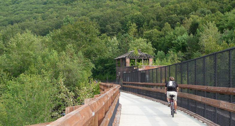
The bridge carrying the Lehigh Gorge Trail and a railroad over the Lehigh River in Jim Thorpe, PA. Photo by Listroiderbob2.
Location: PA Joins Jim Thorpe W to SR 902.
- States: Pennsylvania
The trail surface is natural, consisting of dirt, roots, rocks, and occasional coal chunks. The trail runs downhill on the former right-of-way of the Mauch Chunk Switchback Railway from Summit Hill to Jim Thorpe. Located midway on the trail is Mauch Chunk Lake Park which provides parking for hiking & biking up and down the trail.
When it began operating, the Switchback Railroad was the second railroad in America and the first in Pennsylvania. Built to haul coal from the Summit Mine to the Lehigh Canal, the railroad evolved from a gravity-powered system (The Down Track) and mule-powered system (The Back Track) to a 95% gravity-run operation.
In the late 1800s, as steam locomotion became more commonplace, the Switchback Railroad was needed less for coal transport but was adapted into a passenger operation. From 1870, and for the next six decades, the Switchback Gravity Railroad evolved into a popular tourist attraction, one that thrilled visitors with 50-mile-per-hour rides downhill through the lush landscape of the Lehigh Valley. It is credited with inspiring the creation of the roller coaster. The tourist attraction closed in 1929, and the Switchback was sold for scrap in 1937 and converted to a trail in 1977.
Today the Switchback Trail still inspires tourists and locals alike. Two 9-mile routes intersect to make up the Switchback. Regardless of which you choose, start in Summit Hill and bike downhill toward Jim Thorpe. The grade in reverse is challenging. Although this trail doesn't require a lot of pedaling, it commands your attention. For a shorter ride, pick up the trail in Mauch Chunk Lake Park, which has parking, restrooms, picnic areas, and campgrounds. Fishing is permitted.
Accessibility Information
No text provided.
Allowed Uses:
Bicycling Hiking/WalkingPublic Contact
Carbon County Recreation AuthorityP.O. Box 7
Jim Thorpe, PA 18229
Contact the trail manager for current maps and visiting details.
More Details
- Elevation (low): --
- Elevation (high): --
- Elevation (cumulative): --
- Part of a Trail System? No
- Surface (primary): --
- Surfaces (additional): --
- Tread Width (average): 0"
- Tread Width (minimum): --
- Running length (minimum): --
- Tread Grade (average, percent): --
- Tread Grade (maximum):
- Running length (maximum): --
- Cross-slope (average, percent): --
- Cross-slope (maximum): --
- Running length (maximum): --
- Certified as an NRT
Nov 9, 1980

