Table Rock
check with the trail manager for updated details before visiting.
Table Rock
State
- Length
9 miles
- Elevation Gain
--
- Route Type
out & back
- Length
9 miles - Elevation Gain
-- - Route Type
out & back
The red blazed, 3.6-mile Table Rock Trail is a very rugged hike within the scenic and popular Table Rock State Park in the northwest corner of South Carolina.
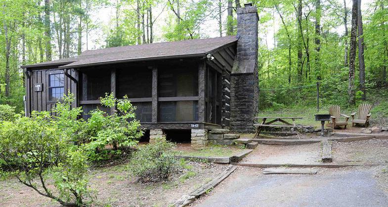
Historic District log cabin in Table Rock State Park. Photo by Bill Fitzpatrick.

A water fall on Carrick Creek Nature Trail, Table Rock State Park, South Carolina. Photo by John Foxe.

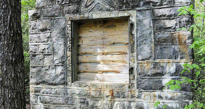
Table Rock Civilian Conservation Corps Camp Site — a stone lodge the CCC restored. Photo by Bill Fitzpatrick.
Location: At Table Rock SP NW of Greenville near Stateline.
- States: South Carolina
There are over 12 miles of trails in the park, but only the Table Rock National Recreation Trail ascends 2,000 feet to the summit of the imposing granite dome, Table Rock Mountain (3,124 feet). The hike begins at the Nature Center and ascends steeply through an open forest strewn with boulders. Along the way, you will see vegetation typical of the Southern Appalachians: dominant oak and hickory trees with scattered pines and hemlock. As you might guess, the strenuous hike offers the reward of spectacular views from the higher rock outcrops.
Accessibility Information
No text provided.
Allowed Uses:
Hiking/WalkingPublic Contact
South Carolina Division of Parks1205 Pendelton St.
Columbia, SC 29201
Contact the trail manager for current maps and visiting details.
More Details
- Elevation (low): --
- Elevation (high): --
- Elevation (cumulative): --
- Part of a Trail System? No
- Surface (primary): --
- Surfaces (additional): --
- Tread Width (average): 0"
- Tread Width (minimum): --
- Running length (minimum): --
- Tread Grade (average, percent): --
- Tread Grade (maximum):
- Running length (maximum): --
- Cross-slope (average, percent): --
- Cross-slope (maximum): --
- Running length (maximum): --
- Certified as an NRT
May 5, 1976