Table Rock Lakeshore Trail
check with the trail manager for updated details before visiting.
Table Rock Lakeshore Trail
U.S. Corps of Engineers
Backcountry Trail
- Length
2.7 miles
- Elevation Gain
--
- Route Type
out & back
- Length
2.7 miles - Elevation Gain
-- - Route Type
out & back
The Table Rock Lakeshore Trail is located just south of Table Rock Lake Dam in Branson, Missouri.
Location: South of Table Rock Lake Dam in Branson, MO
- States: Missouri
- Counties: Taney
The trail is 2.7 miles in length, and eight feet in width, and runs parallel to the beautiful shores of Table Rock Lake. Built for optimum accessibility, the trail allows everyone the ability to enjoy the area's wildlife, rock formations, and vegetation as well as four local attractions.
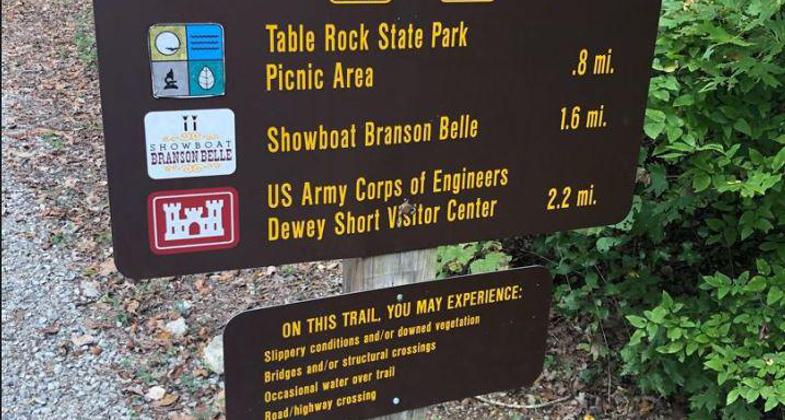
The trail starts at the Dewey Short Visitors Center where you can view and learn about the history of the U.S. Army Corps of Engineers, and also the area's wildlife and its habitat. It then takes you by the Showboat Branson Belle where you can enjoy lunch or a dinner cruise on Table Rock Lake. The trail then runs through Table Rock State Park and ends at the State Park Marina, which has camping accommodations as well as boat rentals.
The Table Rock Lakeshore Trail serves many tourists from around the nation as well as the local population and supports many activities such as hiking, bicycling, inline skating, and photography.
Accessibility Information
No text provided.
Allowed Uses:
Bicycling Swimming Dogs, off leash Hiking/WalkingOther Activities
- Fishing
- Wildlife viewing / observation
Public Contact
Ken FoersterlingUS Army Corps of Engineers
Table Rock State Park
Branson, MO 65616
(417) 334-4101
Contact the trail manager for current maps and visiting details.
More Details
- Elevation (low): 923
- Elevation (high): 938
- Elevation (cumulative): --
- Part of a Trail System? No
- Surface (primary): Paved
- Surfaces (additional): Paved
- Tread Width (average): 96"
- Tread Width (minimum): --
- Running length (minimum): --
- Tread Grade (average, percent): 5
- Tread Grade (maximum): 8
- Running length (maximum): --
- Cross-slope (average, percent): --
- Cross-slope (maximum): --
- Running length (maximum): --
- Certified as an NRT
Jun 3, 2005


