Taconite Trail
check with the trail manager for updated details before visiting.
Taconite Trail
State
Backcountry Trail
- Length
172 miles
- Elevation Gain
--
- Route Type
out & back
- Length
172 miles - Elevation Gain
-- - Route Type
out & back
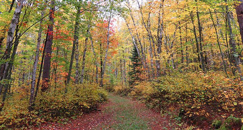
Taconite State Trail is a scenic experience twisting through aspen, birch, and pine forest leading to many isolated lakes and streams.
Location: Superior National Forest, In Superior National Forest, links US 53 and SR 73 NW of Virginia.
- States: Minnesota
- Counties: Itasca, St. Louis
The Taconite State Trail extends 165 miles from Grand Rapids, Minnesota to Ely, Minnesota, and intersects the Arrowhead State Trail west of Lake Vermilion. On the Grand Rapids end, the trail is paved for the first 6 miles for in-line skating and biking. The rest of the trail is a natural surface used primarily in the winter months for snowmobiling. In the summer, several areas contain standing water, but some areas are suitable for horseback riding, hiking, and mountain biking.
Taconite State Trail is a scenic experience twisting through aspen, birch, and pine forest leading to many isolated lakes and streams. Exploring the trail from Grand Rapids and heading north depicts the previous impact of the iron ore mining industry. As the trail goes north, the terrain becomes rolling and winding through thick forests. The Taconite Trail leads through State and National Forest land as well.
Along the Taconite Trail, there are eight trail waysides and picnic areas which provide views of scenic vistas, rivers, and lakes.
The trail is located in the state of MN and Superior National Forest lands and is operated and maintained by the State of MN Dept. of Natural Resources.
Accessibility Information
No text provided.
Allowed Uses:
Bicycling Dogs, on leash Equestrian Hiking/Walking Snow, cross-country skiingOther Activities
- Camping
- Snow, snow play general
Public Contact
Dave SchotzkoMinnesota DNR Trails and Waterways
P.O. Box 388
Tower, MN 55790
(218) 753-6256
Contact the trail manager for current maps and visiting details.
More Details
- Elevation (low): --
- Elevation (high): --
- Elevation (cumulative): --
- Part of a Trail System? No
- Surface (primary): Soil
- Surfaces (additional): Soil
- Tread Width (average): 127"
- Tread Width (minimum): --
- Running length (minimum): --
- Tread Grade (average, percent): 5
- Tread Grade (maximum): 20
- Running length (maximum): --
- Cross-slope (average, percent): --
- Cross-slope (maximum): --
- Running length (maximum): --
- Certified as an NRT
Dec 12, 1979


