Tent Rocks Trail
check with the trail manager for updated details before visiting.
Tent Rocks Trail
Bureau of Land Management
Backcountry Trail
- Length
2 miles
- Elevation Gain
--
- Route Type
out & back
(1 review)
- Length
2 miles - Elevation Gain
-- - Route Type
out & back
The national monument includes a national recreational trail. It is for foot travel only and contains two segments that provide opportunities for hiking, birdwatching, geologic observation, and plant identification.

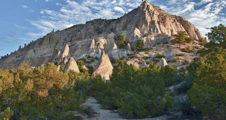
Tent rocks viewed from the trail.

Photo by Ken Squires.

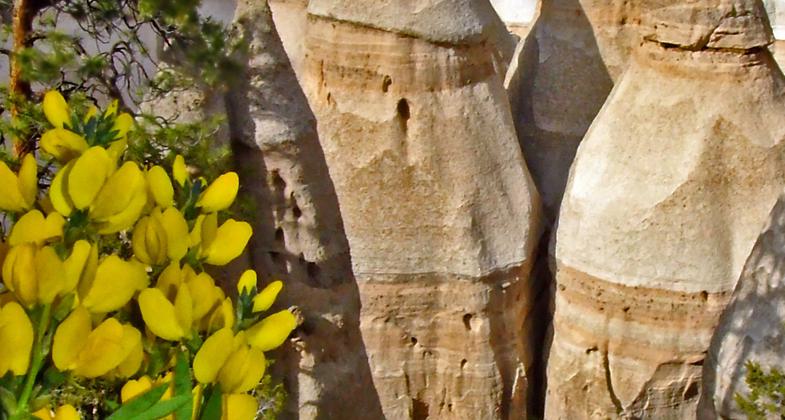
Golden Pea (Thermopsis pinetorum) grows alongside the upper Tent Rocks Trail. Photo by Stephen Ausherman.

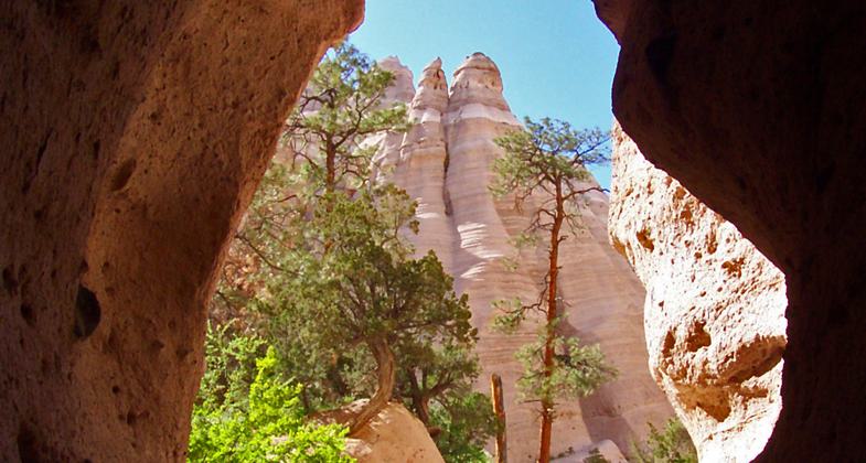
Hiker reaches the end of the slot on Tent Rocks Trail. Photo by Stephen Ausherman.

Hiker follows Tent Rocks Trail into the slot canyon. Photo by Stephen Ausherman.
Location: Kasha-Katuwe Tent Rocks National Monument
- States: New Mexico
- Counties: Sandoval
The national monument includes a national recreational trail. It is for foot travel only and contains two segments that provide opportunities for hiking, birdwatching, geologic observation, and plant identification. Both segments of the trail begin at the designated monument parking area. The Cave Loop Trail is 1.2 miles long and rated as easy. The more difficult Canyon Trail is a 1.5-mile, one-way trek into a narrow canyon with a steep (630-ft) climb to the mesa top for excellent views of the Sangre de Cristo, Jemez, Sandia mountains, and the Rio Grande Valley. Both trails are maintained; however, during inclement weather, the canyon may flash flood, and lightning may strike the ridges. The Veterans Memorial Trail is a 1-mile long loop trail, rated as very easy, and is wheelchair accessible. The Veterans Memorial is located at the end of a 3-mile-long gravel surfaced road overlooking picturesque Peralta Canyon and Jemez Mountain peaks. Picnic tables, shelters, and toilets are available at both sights.
Accessibility Information
No text provided.
Reviews
Madison Vandersee
Experience the beautiful and unique landscape
The Canyon Trail is a MUST for anyone visiting the area and feeling up to a challenge. It provides a canyon hike with narrow cliff walls and a nearly vertical hike to the most beautiful view of the mountains. The beginning of the hike is not too strenuous, but the altitude and heat can be brutal on the steep incline in the second half of the hike. This is definitely a trail to take your time and enjoy the beauty of the rock formations and environment! My favorite hiking site in the area so far!
Allowed Uses:
Hiking/WalkingPublic Contact
Bureau of Land Management Rio Puerco Field Office435 Montaño NE
Albuquerque, NM 87107
(505) 761-8700
www.blm.gov/nm/st/en/prog/recreation/rio_puerco/kasha_katuwe_tent_ro
Contact the trail manager for current maps and visiting details.
More Details
- Elevation (low): --
- Elevation (high): --
- Elevation (cumulative): --
- Part of a Trail System? No
- Surface (primary): Soil
- Surfaces (additional): --
- Tread Width (average): 0"
- Tread Width (minimum): --
- Running length (minimum): --
- Tread Grade (average, percent): --
- Tread Grade (maximum):
- Running length (maximum): --
- Cross-slope (average, percent): --
- Cross-slope (maximum): --
- Running length (maximum): --
- Certified as an NRT
Sep 19, 1992


