The Forever Wild Freedom Hills Trail System
check with the trail manager for updated details before visiting.
The Forever Wild Freedom Hills Trail System
State
Backcountry Trail
- Length
14.7 miles
- Elevation Gain
--
- Route Type
Loop
- Length
14.7 miles - Elevation Gain
-- - Route Type
Loop
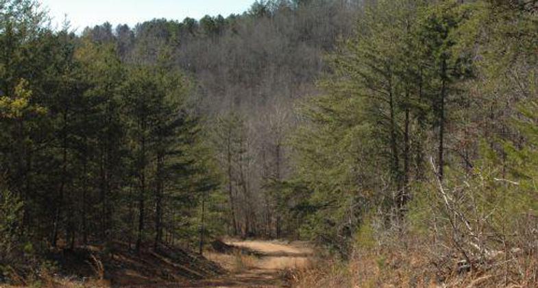
The Forever Wild Freedom Hills Trail System is located on the Freedoms Hills Wildlife Management Area in Colbert County, 5 miles south of Highway 72 near Barton and Cherokee, Ala. The trail system is open from March 1st until the beginning of the Turkey Season and from May 1st to September 30th each year.
Location: Located in the Forever Wild Freedom Hills Wildlife Management Area in Colbert County, 5 miles south of HIghway 72 near Barton and Cherokee, AL.
- States: Alabama
- Counties: Colbert
The Forever Wild Freedom Hills Trail System is located on the Freedoms Hills Wildlife Management Area in Colbert County, 5 miles south of Highway 72 near Barton and Cherokee, Ala. The trail system is open from March 1st until the beginning of the Turkey Season and from May 1st to September 30th each year. Projects such as these new horse trails help Alabamians experience our rich natural diversity firsthand from the unique perspective of horseback.
The trail system was created using existing woods roads that are closed to vehicle traffic outside of the normal hunting season and connecting trails. The trail system offers 14.7 miles of diverse landscape and conditions for horseback riding enthusiasts to enjoy Alabama's rich natural diversity firsthand. Riders have the option of staying on the main loop called Bugg Mill Hollow Loop for a 6.5-mile trip. This loop begins and ends at the trailhead parking lot located off of County Road 33, near the community of Newsome Springs. There are three additional loops that feed off of Bugg Mill Hollow Loop that provide riders with alternate durations of the riding experience. Blue Hole Rd Loop offers an additional 2.2 miles, Mills Ridge Loop offers an additional 2.2 miles, and McCaig Hollow Loop offers an additional 3.8 miles.
While the initial trail work was performed by the ADCNR staff, this project is intended to follow other successful recreational ventures utilizing volunteers to maintain the existing trails. These efforts have capitalized on the membership of the Alabama Horse Counsel and other local clubs that support horse back riding.
All riders are required to have a valid Alabama Wildlife Management Area License and a Freedom Hills Wildlife Management Area permit. Licenses can be purchased online at https://www.outdooralabama.com... or by phone at 1-888-848-6887 24 hours a day 7 days a week.
The Alabama Department of Conservation and Natural Resources promotes wise stewardship, management and enjoyment of Alabama's natural resources through five divisions: Marine Police, Marine Resources, State Lands, State Parks, and Wildlife and Freshwater Fisheries. To learn more about ADCNR, visit https://www.outdooralabama.com...
Accessibility Information
No text provided.
Allowed Uses:
EquestrianOther Activities
- Hunting
Public Contact
Doug DeatonAL Dept of Conservation and Natural Resources
64 North Union St, Suite 464
Montgomery, AL 36130
[email protected] • (334) 242-3484
Contact the trail manager for current maps and visiting details.
More Details
- Elevation (low): 700
- Elevation (high): 900
- Elevation (cumulative): --
- Part of a Trail System? No
- Surface (primary): Soil
- Surfaces (additional): Grass or Vegetation, Rock, boulders, Rock, crushed, Rock, smooth, Sand, Soil, Water, calm
- Tread Width (average): 48"
- Tread Width (minimum): 36
- Running length (minimum): --
- Tread Grade (average, percent): 5
- Tread Grade (maximum): 15
- Running length (maximum): --
- Cross-slope (average, percent): 2
- Cross-slope (maximum): --
- Running length (maximum): --
- Certified as an NRT
May 29, 2012


