The Great Lakes Seaway Trail
This information is a public record of the 1983 NRT application and may be out of date if it has not been updated by a trail manager --
check with the trail manager for updated details before visiting.
check with the trail manager for updated details before visiting.
The Great Lakes Seaway Trail
Nonprofit
- Length
365 miles
- Elevation Gain
--
- Route Type
out & back
- Length
365 miles - Elevation Gain
-- - Route Type
out & back

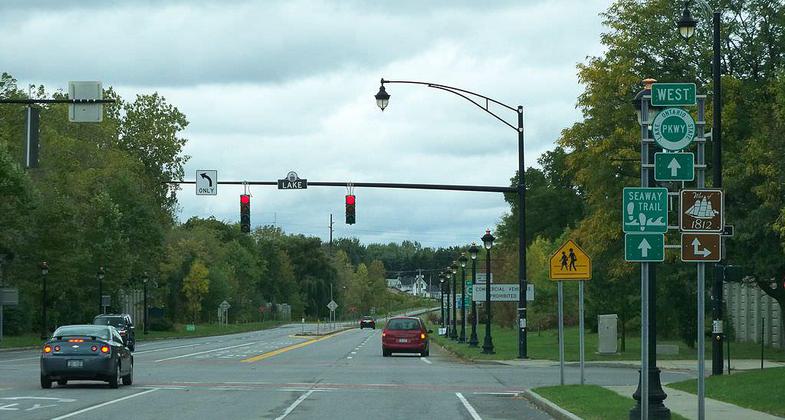
Eastern terminus of the Lake Ontario State Parkway at Lake Avenue in Charlotte, Rochester, New York, as seen from Pattonwood Dri. Photo by TwinsMetsFan.

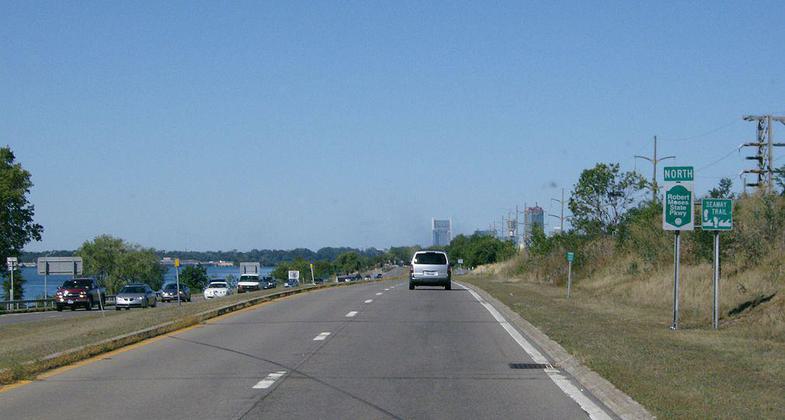
Approaching Niagara Falls on the northbound Robert Moses State Parkway, part of the Great Lakes Seaway Trail. Photo by TwinsMetsFan.

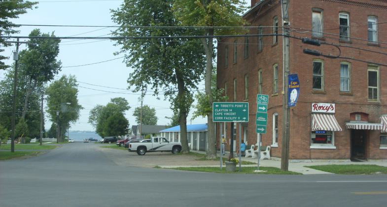
A 90-degree turn on New York State Route 12E northbound in Cape Vincent. Straight ahead is Lake Ontario. Photo by Doug Kerr/wiki.
Location:
- States: New York
The Great Lakes Seaway Trail, formerly known as the Seaway Trail, is a scenic driving route that follows the shores of Lake Erie, the Niagara River, Lake Ontario, and the St. Lawrence River in New York and Pennsylvania. One of the first roads in America to be designated as a National Scenic Byway, the Great Lakes Seaway Trail includes unique historical locations and cultural heritage sites in addition to outstanding views and scenic vistas.
Accessibility Information
No text provided.
Allowed Uses:
Bicycling Hiking/WalkingOther Activities
- Camping
- Heritage and history
Public Contact
Seaway Trail Inc.109 Barracks Drive
Sacketts Harbor, NY 13685
[email protected] • (315) 646-1000
www.seawaytrail.com
Contact the trail manager for current maps and visiting details.
More Details
- Elevation (low): --
- Elevation (high): --
- Elevation (cumulative): --
- Part of a Trail System? No
- Surface (primary): Paved
- Surfaces (additional): --
- Tread Width (average): 0"
- Tread Width (minimum): --
- Running length (minimum): --
- Tread Grade (average, percent): --
- Tread Grade (maximum):
- Running length (maximum): --
- Cross-slope (average, percent): --
- Cross-slope (maximum): --
- Running length (maximum): --
- Certified as an NRT
Dec 11, 1983

