The Rivanna Trail
check with the trail manager for updated details before visiting.
The Rivanna Trail
Nonprofit
- Length
20 miles
- Elevation Gain
--
- Route Type
out & back
- Length
20 miles - Elevation Gain
-- - Route Type
out & back

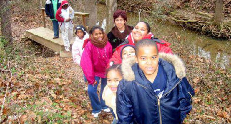
The Rivanna Trail is an urban wilderness trail where hikers can exercise, have fun with friends, and learn about the world of na.
Location: Charlottesville, VA
- States: Virginia
- Counties: Albemarle
A twenty-mile rustic footpath that meanders through the natural greenbelt that surrounds the City of Charlottesville, the trail is bounded by the Rivanna River, two of its tributaries (Meadow and Moore's Creeks), and a small undeveloped mountain called Observatory Hill. By hiking on the Rivanna Trail, both residents and visitors alike can quickly and easily leave behind the stresses of modern city life. The Rivanna Trail is unique in that it is truly an urban wilderness trail.
The Rivanna Trail is a well-used well-loved urban treasure. It was built and is maintained entirely by community volunteers. The Trail passes through six City parks; connects neighborhoods and schools; skirts community garden plots; lies within reach of restaurants, hotels, and medical facilities; takes hikers safely under busy roads through culverts; traverses University of Virginia land; and provides hikers with views of historic mills and dams.
Members of the community highly value the opportunity to have a wilderness experience right outside their doorsteps. Within minutes, a hiker can reach a place where he hears only the sounds of nature: rushing water, wind in the trees, birds -- no cars or machines. He can walk through wetlands, streams, floodplains, and fields transforming into forests. He can touch and walk under trees more than a hundred years old. Sightings of foxes and bears are not uncommon. The Trail has been nominated as a Virginia Birding and Wildlife Trail due to its more than 100 identified bird species. Environmental groups whose mission it is to interpret nature routinely use the Trail as a resource.
Most importantly, because it completely encircles the City, the Rivanna Trail is accessible to every member of the community. The Trail is within walking distance of all neighborhoods. People who are not fortunate enough to have the time or money to travel to wilderness areas or national parks have the opportunity for hands-on experiences with nature right outside their doors. Children have a safe nearby environment in which to learn about forests and streams. Teachers walk with their students along the Trail to reinforce science lessons. Members of the Senior Center and several churches sponsor weekly Trail walks. Residents commute to work, school, and university along the Trail. People with accessibility needs can visit a two-mile stretch of riverside trail.
The Rivanna Trail has made possible invaluable lessons to the community about watershed protection. Virginia has recently experienced several years of severe drought and now one year of record heavy rains. The Rivanna Trail and the greenbelt through which it passes have provided effective and natural illustrations of the valuable role riparian buffers play in preserving streams and rivers. Hundreds of citizens walk on the Rivanna Trail daily. They have seen for themselves how a forest and its floodplains can protect both a stream and our downstream neighbors. Our Trail users are passionate protectors of both the Rivanna Trail and the streams along which it travels.
Accessibility Information
No text provided.
Allowed Uses:
Hiking/WalkingPublic Contact
Diana FosterRivanna Trails Foundation
P.O. Box 1786
Charlottesville, VA 22902
[email protected] • (434) 964-1022
www.rivannatrails.org
Contact the trail manager for current maps and visiting details.
More Details
- Elevation (low): 400
- Elevation (high): 780
- Elevation (cumulative): --
- Part of a Trail System? No
- Surface (primary): Soil
- Surfaces (additional): --
- Tread Width (average): 30"
- Tread Width (minimum): --
- Running length (minimum): --
- Tread Grade (average, percent): 10
- Tread Grade (maximum): 25
- Running length (maximum): --
- Cross-slope (average, percent): --
- Cross-slope (maximum): --
- Running length (maximum): --
- Certified as an NRT
May 31, 2002

