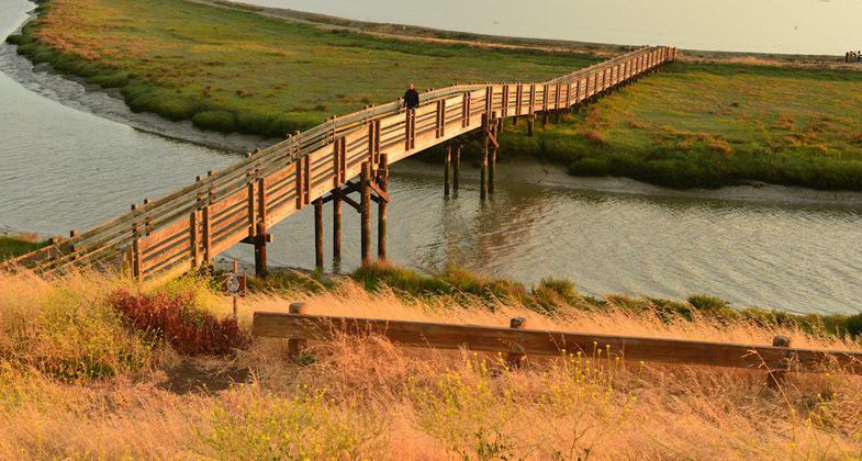
Tidelands
This information is a public record of the 1981 NRT application and may be out of date if it has not been updated by a trail manager --
check with the trail manager for updated details before visiting.
check with the trail manager for updated details before visiting.
Tidelands
U.S. Fish and Wildlife Service
- Length
1.3 miles
- Elevation Gain
--
- Route Type
out & back
- Length
1.3 miles - Elevation Gain
-- - Route Type
out & back
Tidelands Trail is 1.8 miles. It is a loop trail. This trail allows walkers, bicycles and dogs on leash.
Location: Suburban, At San Francisco Bay NWR, accessed at interpretive center at E end of Dumbarton Bridge across the bay.
- States: California
- Counties: Alameda
The Tidelands Trail traverses uplands, tidal slough, salt pond, and tidal salt marsh. Shorebirds and grebes are plentiful in the pond during the winter,and Forster's tern and American Avocets in the summer. The tidal marsh is home to the endangered Ridgeway Quail.
Accessibility Information
No text provided.
Allowed Uses:
Bicycling Dogs, on leash Hiking/WalkingOther Activities
- Wildlife viewing / observation
Public Contact
Matt BrownUS Fish and Wildlife Service
Don Edwards San Francisco Bay National Refuge
Fremont, CA 94536
(510) 792-0222
www.fws.gov/refuge/don_edwards_san_francisco_bay
Contact the trail manager for current maps and visiting details.
More Details
- Elevation (low): --
- Elevation (high): --
- Elevation (cumulative): --
- Part of a Trail System? No
- Surface (primary): Soil
- Surfaces (additional): --
- Tread Width (average): 72"
- Tread Width (minimum): --
- Running length (minimum): --
- Tread Grade (average, percent): --
- Tread Grade (maximum):
- Running length (maximum): --
- Cross-slope (average, percent): --
- Cross-slope (maximum): --
- Running length (maximum): --
- Certified as an NRT
Aug 11, 1981


